| Weather pictures & report of September 10 2004 |
| Cb cluster along convergence line. |
| Synopsis: warm air advection far ahead of cold front. During the day a more humid unstable air with an inactive convergence line was transported from northern France towards Belgium. Forecasted CAPE was well above 700 J/kg and lifted index showed values of -6. Formation of thunderstorms could be expected in the afternoon along this convergence line and around 16:00 CET there was indeed a single cell noted near the French-Belgium border. Airflow at 10.000ft (3km) was NNE with 30 knots, so it was on a "course for interception". I witnessed the young phase of a multi-cell TS but only heard in the distance some rumbling. However the cloudiness was quite fascinating for an hour or so. All pictures taken at Kampenhout in local time (CET). |
| Radar sequence between 1645-1830 CET showing tops up to 13km, a
little above tropopause of 12,5km. My location was just north of the "BR".
(Source: Belgocontrol)
|
|
 |
|
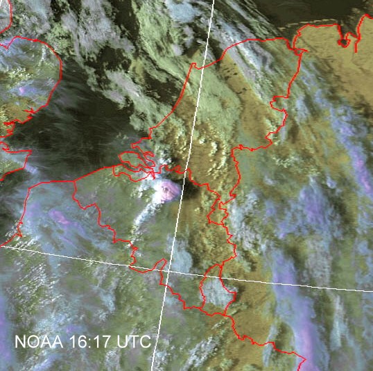
| Sat pic of 18:17 CET showing the "big top" with SW-wards a
street of
towering Cumuli. (Source: NOAA & Wokingham weather)
|
|
 |
|
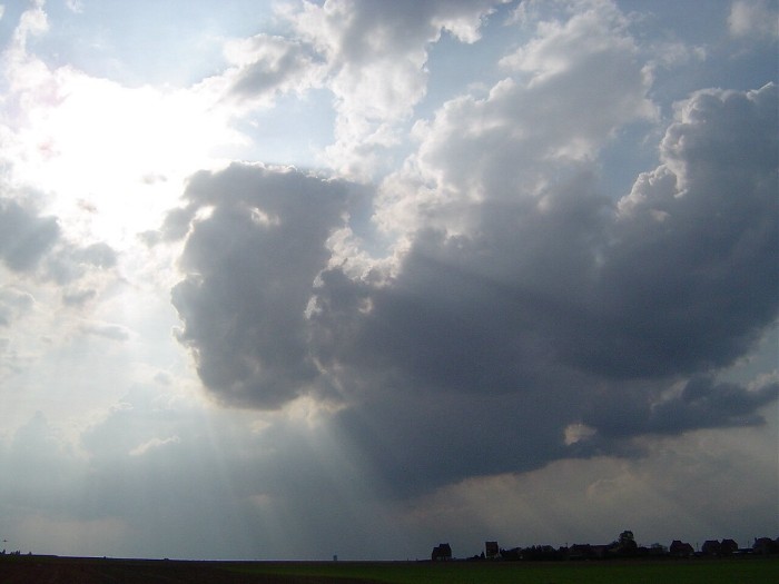
| 17:24 W. In the far distance "towering" Cumuli as a first
sign.
|
|
 |
|
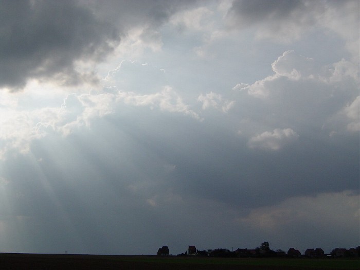
| 17:30 W. True the rays of sun, the towering Cumuli becomes
clearly
visible.
|
|
 |
|
| 17:45 W. Virga becoming visible.
|
|
 |
|
| 17:48 W. Virga associated with a small Cb anvil.
|
|
 |
|
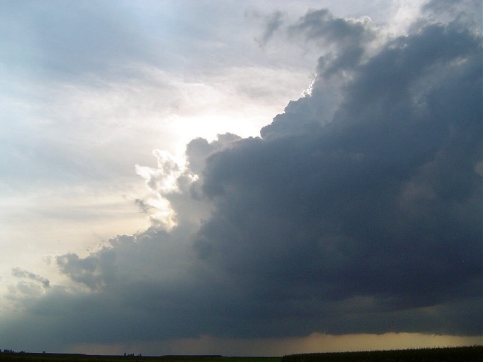
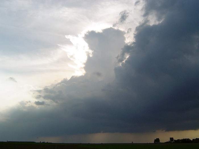
| 17:51 W. On the right of the small Cb anvil a much
larger one becomes visible. This was the one producing a top of +13km with thunderstorm. Sadly the view was a bit
obscured by Cumuliform cloudiness in front.
|
|
 |
|
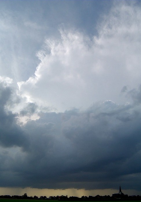
| 17:56 NW. Lucky enough the Cu decreased for a moment on
which the massive Cb anvil on the right became visible.
|
|
 |
|
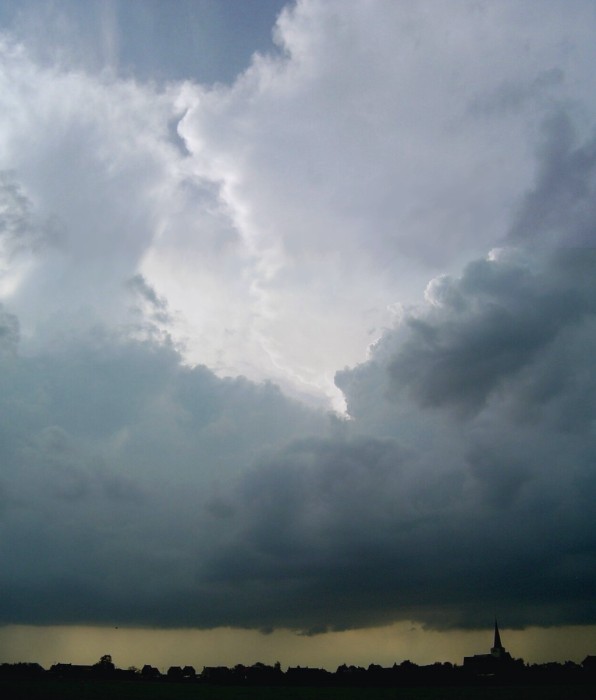
| 18:01 NW. Panoramic view of the Cb anvil. Footprint of
rainfall was sadly obscured by the towering Cu in front.
|
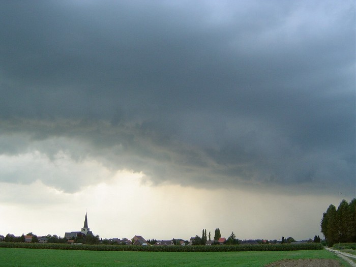 |
| 18:19 N. Towards the end, the towering Cu close to "the mother cell" produced a little shelf cloud. Besides the rumbles, only a few spots of rain were counted. Observations in province of Antwerp showed locally an accumulation of some 10mm of rain. |