| Weather pictures & report of October 20-21 2004 |
| Thundery Cb clusters in warm sector. |
| Synopsis: advection of mild air from SW ahead of cold front. During the day temperatures at surface rised above 20C. CAPE showed values of almost 900 J/kg, LI -3, Showalter slightly negative. In the afternoon/evening some thundery Cb clusters developed in the potential unstable air of the warm sector over northwestern parts of France, crossing Belgium in the evening and early night. Between 20:00 and 01:00 CET (next day) a total of 3 clusters passed mid Belgium of which the first and the last had a lot of lightning activity. The cold front passed my area around 05:00 CET with heavy showers of rain and gusty wind up to 40-45KT. More than 30 mm water was collected between 20:00 and 06:00 CET. All pictures taken at Brussels airport (Zaventem) in CET. The lightning shots have been taken with shutter speed of 1 second. |
 |
| Satellite picture of 18:32 CET showing the development
of several Cb clusters over NW France. Number 1 passed my area around
21:00 CET with a lot of lightning and heavy ppn. Number 2 was
deactivating and passed without thunder around midnight. Number 3
became an active thundery squall line which passed around 01:00 CET. (Source: NOAA and Wokingham
weather)
|
| Radar sequence between 19:30-21:15 CET when a first thundery cluster passed
central Belgium. At a certain moment the tops of precipitation went up to 12
km. It looked like a squall line over SE Belgium. (Source: Belgocontrol)
|
|
|
|
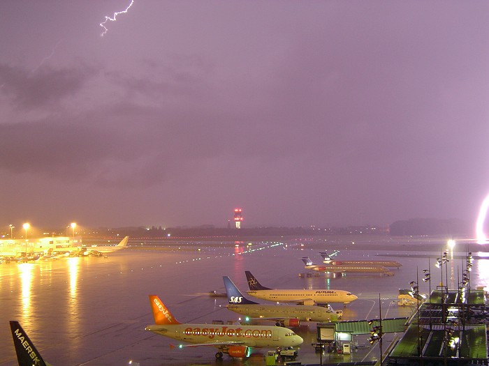
2004/10/20 21:03 NE. Quite a lot of CG lightning did occur on the first trough. In the right of the picture a bold CG stroke on the runway, illuminating the whole area and producing a shivering bang.
|
 |
|
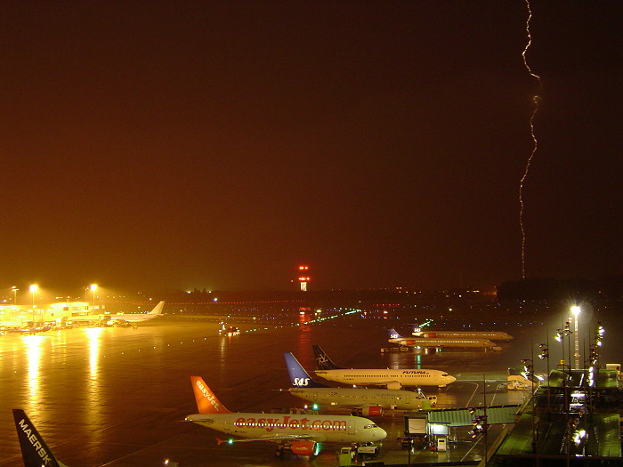
2004/10/20 21:05 NE. Another CG that struck earth behind the trees. This shot was taken on the fading moment of the lightning giving a quite special effect and is one of the few advantages with a shutter speed of one second.
|
 |
|
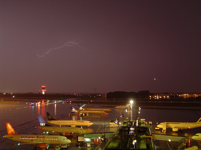
2004/10/20 21:15 NE. A little later lightning was limited to some CC or IC. The flash point in the sky is an incoming aircraft.
|
|
Radar sequence between 23:30-02:00 CET showing the second (in northeast) and third Cb cluster. The latter became clearly a squall line with precipitation tops again up to 12 km. (Source: Belgocontrol.)
|
 |
|
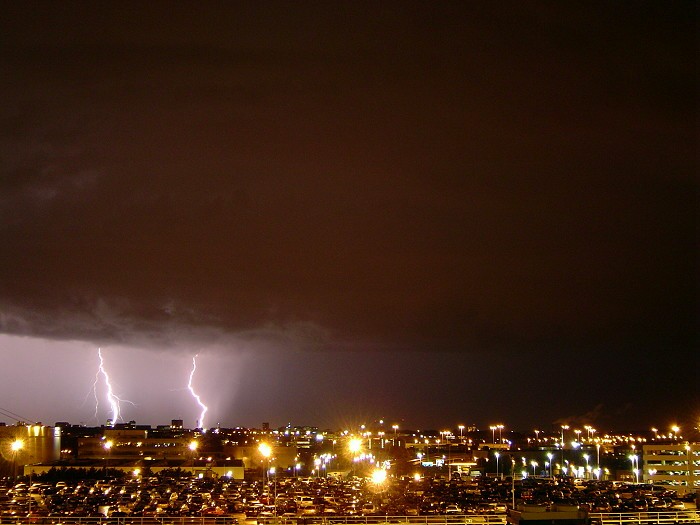
2004/10/21 01:01 SW. The squall line produced every 20 seconds or so a CG with two of them captured over Brussels town. In front a massive shelf cloud was also visible.
|
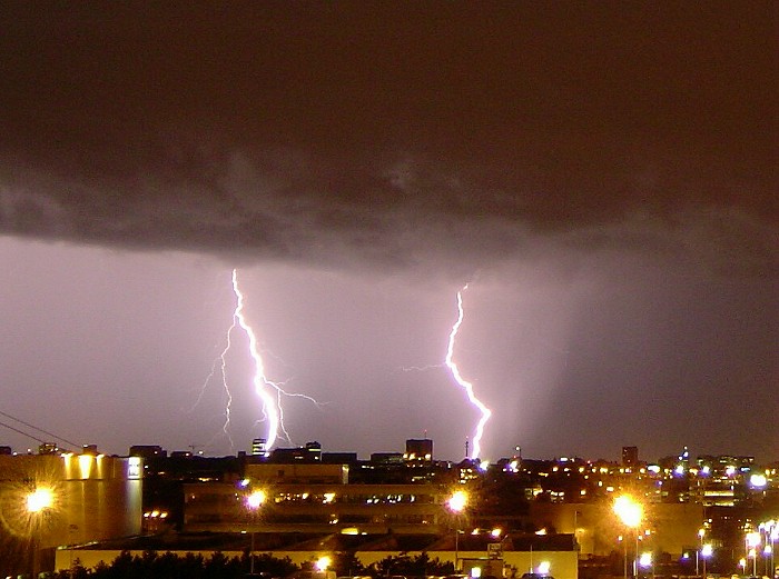 |
| 2004/10/21 01:01 S. Detail of the twin CG stroke, with
the left one forked and the right one rather bold. Moments later precipitation was quite heavy
ending all possibilities for further descent shots.
|