| Weather pictures & report of July 28 2005 |
| Multicell & supercell thunderstorms along convergence lines. |
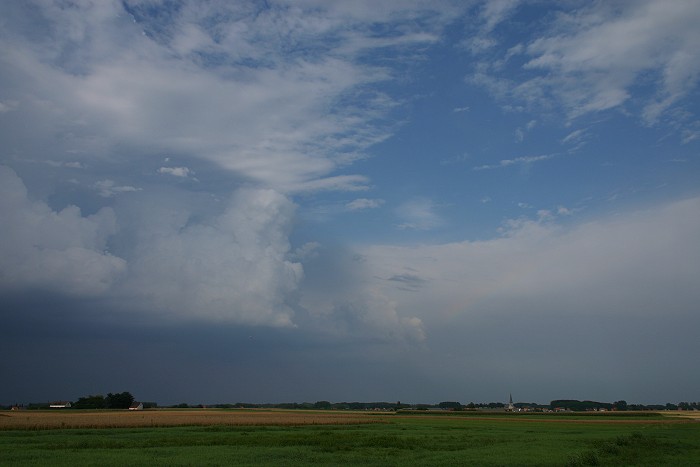
| Synopsis: advection of deep unstable air from SW. During the afternoon severe thunderstorms developed on convergence lines coming in from France. In province Hainaut (between Ath and Lessines) there was even a brief tornado touchdown. In my area an exploding thunderstorm was formed, giving only a few rumbles in the distance but with a nice Cb show. The cell moved NNE wards giving later "golf ball size" hail in province of Antwerp (near Turnhout). All pics taken at Kampenhout. |
|
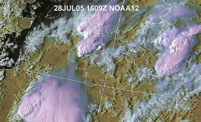
Satellite picture at 1810 CET. The small cell near my area (red K) was responsible for the photographs below. The massive thunderstorm complex just SW and W was responsible for a brief tornado touchdown near Ath. (Source satpicture: Wokingham weather)
|
|
Radar sequence between 1700-1945 CET. Developing
thunderstorms with tops up to around 12km. Over western parts of Belgium
a splitting supercell can be spotted, with the left mover fading away. (Source radar picture: Belgocontrol)
|
|
|
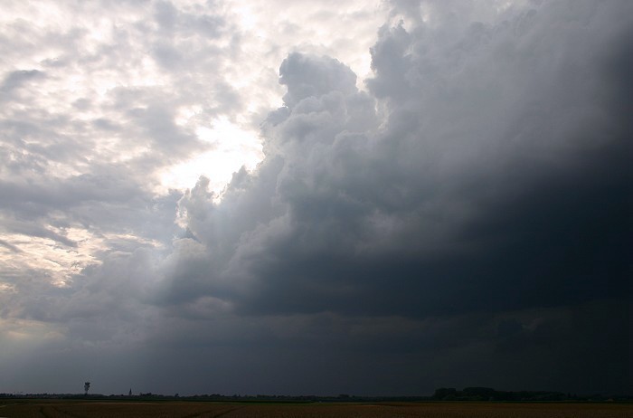
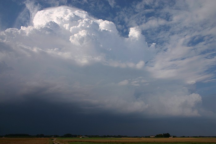
28/07/2005 1821 W. Left flank updraft of the Cb.
|
 |
|
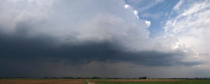
28/07/2005 1822 NE. Right flank updraft of the Cb.
|
 |
|
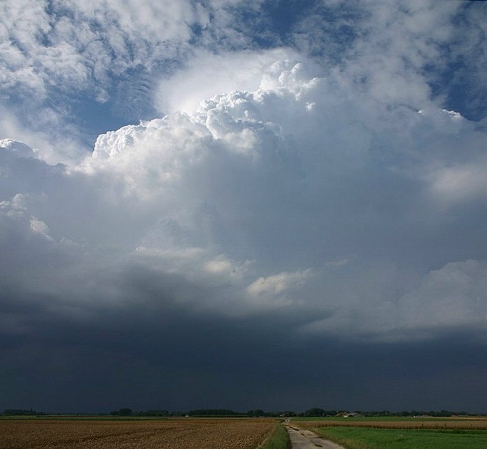
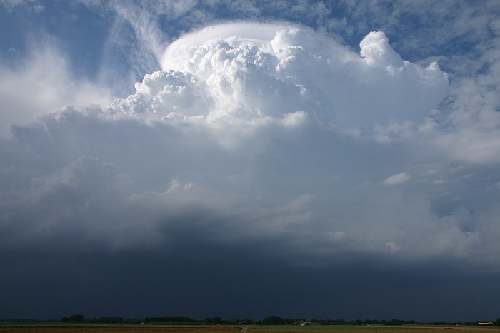
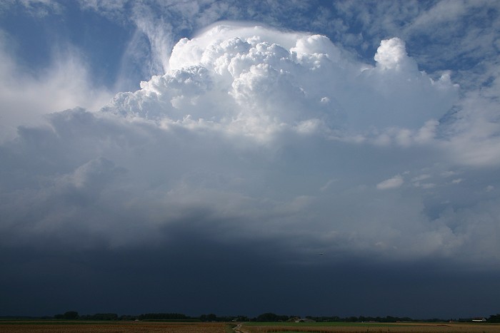
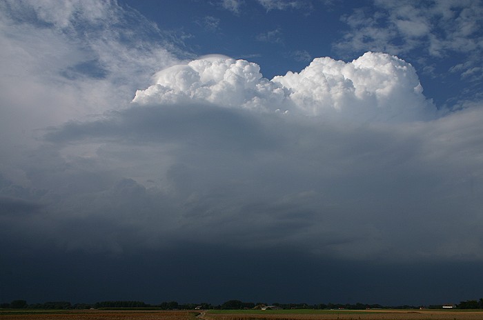
28/07/2005 1830 NNW. Central and main updraft of the storm, with the upper
part wrapped in a pileus.
|
 |
|
28//07/2005 1833 NE. Nice play of the shadow + part of a rainbow.
|
 |
|
28/07/2005 1834 NNW. A big pileus feature was briefly formed.
|
 |
|
28/07/2005 1835 NNW. Pileus changing shape.
|
 |
|
28/07/2005 1836 NNW. Massive Cumulus congestus pileus with behind the main Cb.
|
 |
|
28/07/2005 1842 NNW. Multiple small pileus features.
|