| Weather pictures & report of May 9 2006 |
| Single- and multicell thunderstorms along convergence lines. |
| Synopsis: advection of deep unstable air from E. During the afternoon weak, moderate and isolated severe thunderstorms developed on a convergence line over northern Belgium. Over the Ardennes, some of the more intense thunderstorms were also triggered by orographic circumstances, and included even a right moving supercell near Liège. Over my area three weak thunderstorms passed within 6 hours, but with few precipitation. All pics taken at Kampenhout in local time (CET). |
|
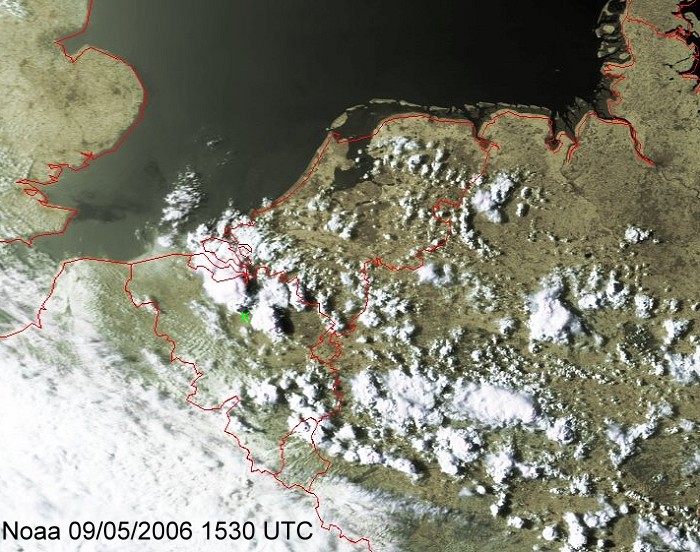
Satellite picture at 1730 CET. Two cells near my area (green K) were responsible for the photographs below. (Source satpicture: NOAA & University of Bern)
|
|
Corresponding radar sequence between 1630-1900 CET showing Cb tops of 10km. (Source radar picture: Belgocontrol)
|
|
|
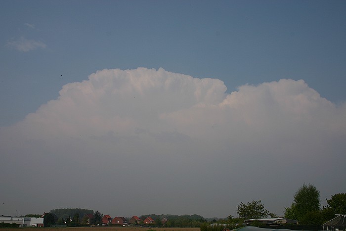
09/05/2006 1731 NNE. Cb top of a single cell, rumbles of thunder were heard, but passed by via the north.
|
 |
|
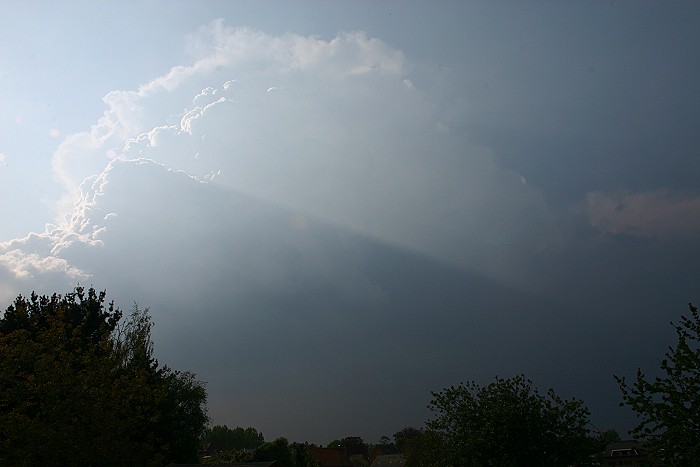
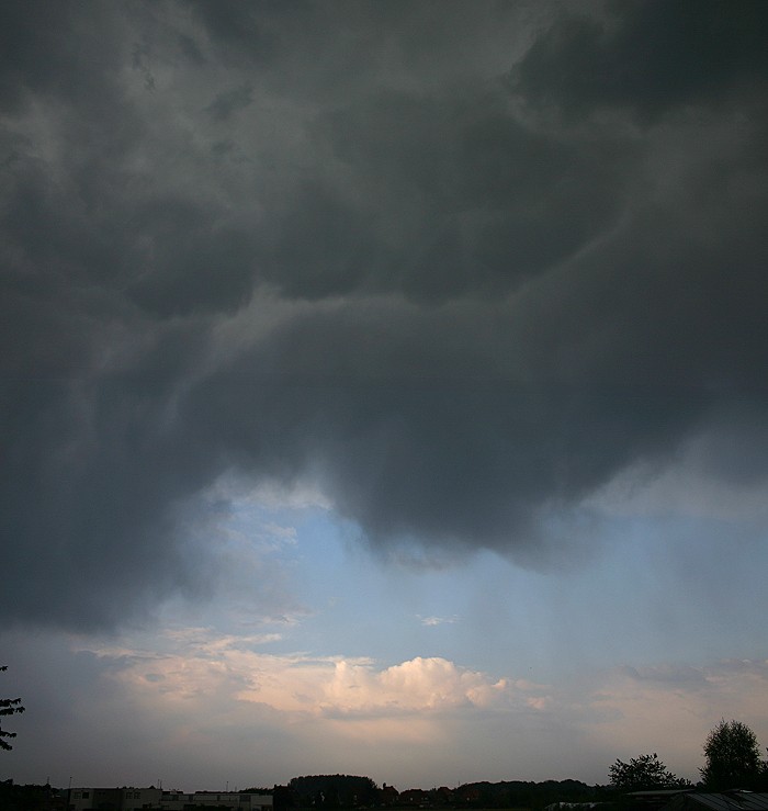
09/05/2006 1745 WNW. Same shower, but with a different appearance. The
towering Cumulus gave a nice crepuscular ray in the hazy sky. Compare
with the radar picture at exactly the same time.
|
 |
|
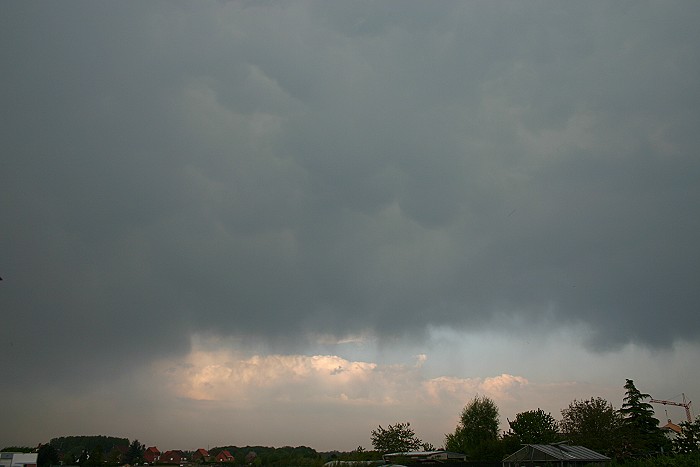
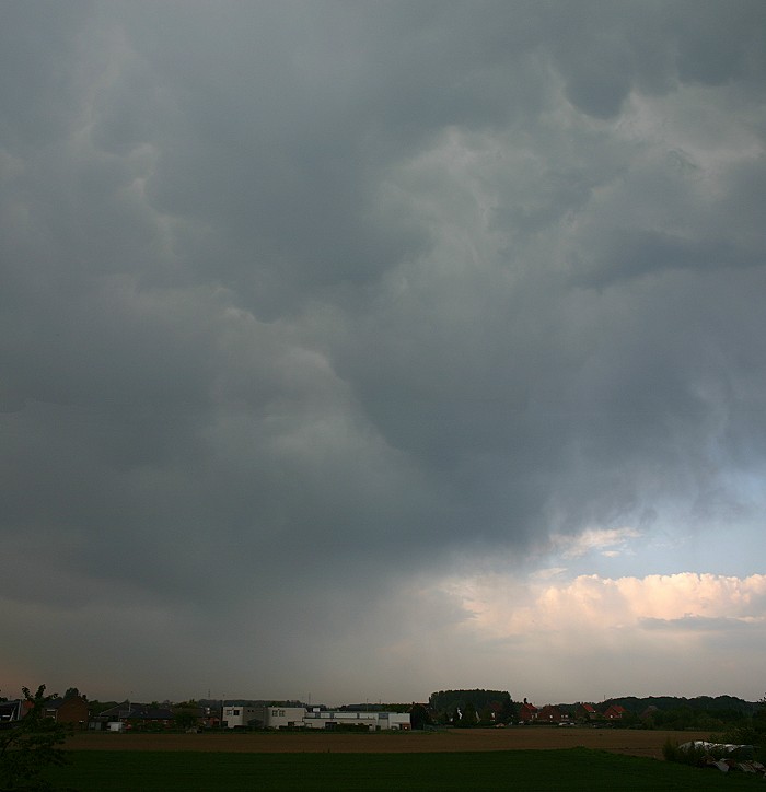
09/05/2006 1819 NE. A multicell thunderstorm showed up giving some mamma
features.
|
 |
|
09//05/2006 1824 N. Vertical panorama stitch showing the inside structure of this Cb cloud with a rather high base.
|
 |
|
09/05/2006 1830 NNE. Another vertical panorama stitch giving a
closer look of the threatening sky: only a few drops fell and each
minute (or two) a cloud-to-cloud strike did occur.
|
 |
|
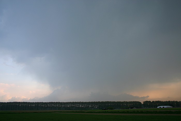
09/05/2006 1850 S. On the opposite side a wall cloud alike structure of this multicell, but in fact nothing more than a rain shaft with a towering Cumulus behind.
|