| Weather pictures & report of June 18 2007 |
| Right moving single cell thunderstorms |
| Synopsis: advection of potentially unstable air from SSW. Behind a trough line and in a moderate airflow, isolated thunderstorms were formed during the afternoon. Several of them were right moving cells, with supercell alike appearance. One of them is reported below. This cell showed up at the Belgian French border and remained active for more than 3 hours, of which two hours with weak to moderate lightning. Locally, it produced rather heavy features, for example over Ninove (province of Oost-Vlaanderen) in form of strong winds, heavy rain and some hail. All pics taken at Steenokkerzeel in local time (CET). |
|
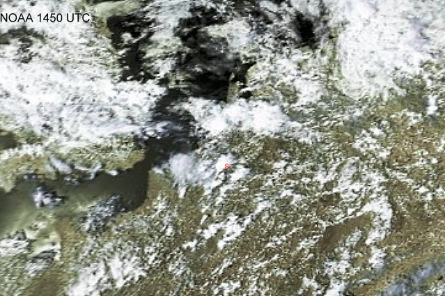
Satellite picture (visual) of 18/06/2007 taken at 1650 CET. Single cell thunderstorms over central parts of Belgium. My location from which I took pictures is at the red "S". (Source satpicture: NOAA)
|
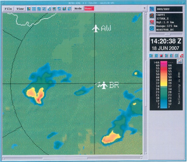
Radar sequence between 1450-1750 CET. My location was near "BR". Single cell thunderstorm moving NE with speed of 25KT and precipitation tops up to 8 km.(Source radar picture: Belgocontrol)
|
|
|
Radar picture (intensity in dBZ) taken at 1620 CET. The cell on the left side was approaching my location at "BR", and had hook echo appearance. (Source radar picture: Belgocontrol).
|
|
|
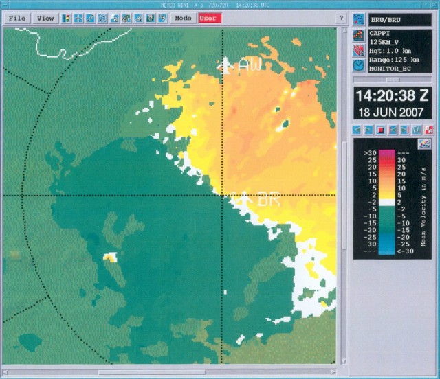
Radar picture (velocity in m/s) taken at 1620 CET. Same cell taken with the velocity image of the radar: yellow to pink are precipitation reflections away, green to blue are precipitation reflections towards the radar, all in meter per second. At the SE quadrant of the cell, there was a couple of times briefly a structure visible resembling to a mesocyclone, although this was each time not very pronounced. (Source radar picture: Belgocontrol).
|
|
|
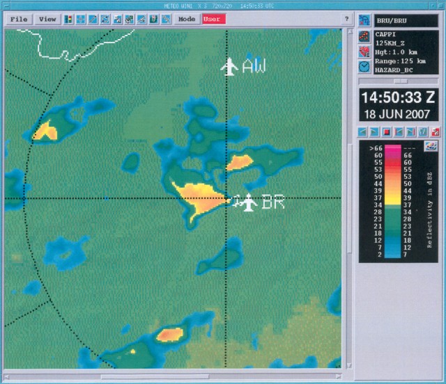
Radar picture (intensity in dBZ) of 1650 CET. The hook echo appearance was corresponding with the lowering of cloud base in the pictures below. (Source radar picture: Belgocontrol).
|
|
|
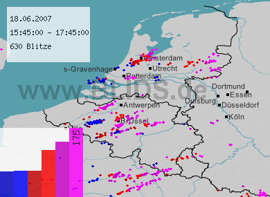
18/06/2007 1545-1745 CET. Lightning sequence of a two hour period. The thunderstorm with lightning trail between Hainaut & Brabant is near location "Brussel" covered with pictures below. Source picture: Blids.
|
|
|
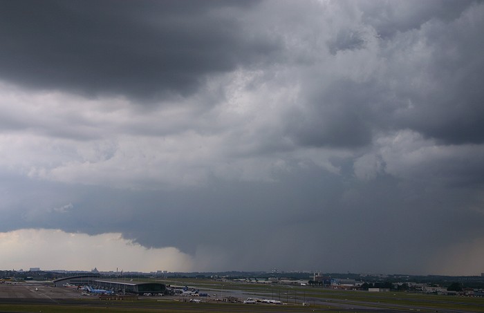
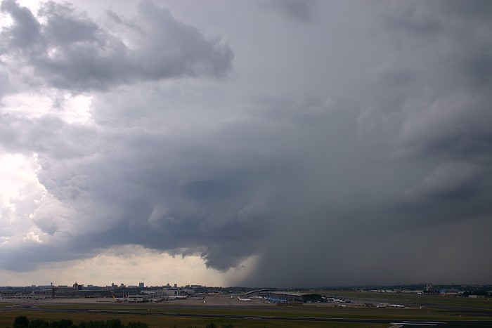
18/06/2007 1639 W. When this cell was approaching, attention was paid to the lowering of the cloud base on the left side of the rain shaft.
|
|
|
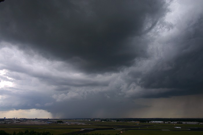
18/06/2007 1643 W. The heavy rain obscured temporary the view of this feature.
|
|
|
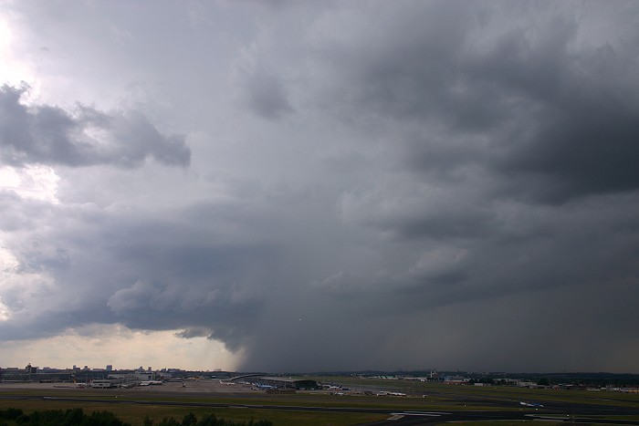
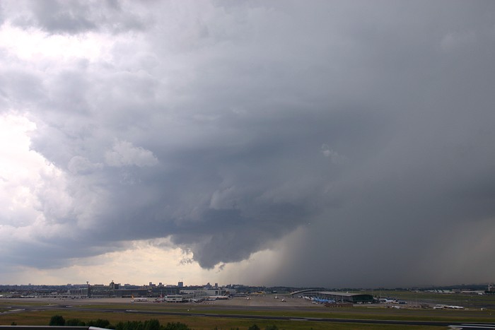
18/06/2007 1647 W. Little later, the lowering became visible again.
|
|
|
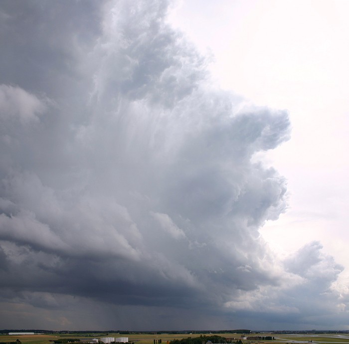
18/06/2007 1649 W. Clear separation between the rain free base with updraft and lowering cloud base on left side, and a so called forward-flank downdraft with rain shaft on the right side. Note that also a rain foot is visible: this is the darker area below the lowered cloud, this due to strong winds that pushed the rain forwards.
|
|
|
18/06/2007 1650 W. The lowering area attached to the storm base could be a so called wallcloud. The next question: could this feature be associated with a supercell. Therefore the wall cloud should be rotating on a vertical axis. As a still image can't give a definite answer a time-lapse might do so.
|
|
18/06/2007 1651-1702 W. In this time-lapse of 10 seconds no real evidence of a rotation on a vertical axis is visible. However the lowering is rotating on an horizontal axis and resembles to a small shelf cloud.
|
|
|
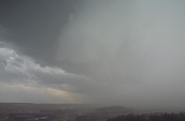
18/06/2007 1704 SSW. Incoming heavy rain which reduced visibilities to 1500 meters and gusty wind up to 37KT, it lasted not more than 5 minutes. Below 3 hours observations sequence measured at my location point. METAR EBBR 181320Z 24008KT 190V270 9999 FEW030 SCT035 22/14
Q1010
|
|
|
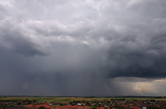
18/06/2007 1715 SE. Backside of the cell.
|
|
|
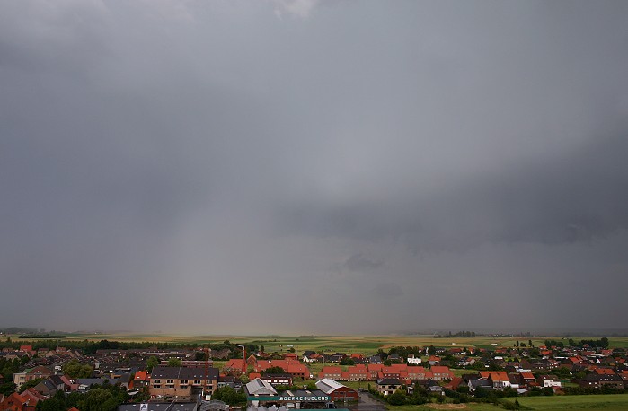
18/06/2007 1717 ESE. A flat rainbow can be observed in the field.
|
|
|
18/06/2007 1718 SSW. At the edge of the cell, a new line of updrafts.
|
|
|
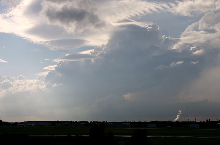
18/06/2007 1849 WNW. Another developing single cell, with pileus and lenticularis features. |