| Weather pictures & report of July 30 2009 |
| Multi-cell thunderstorms along cold front. |
| Synopsis: at 500 hPa an approaching relaxing upper trough from the west of which its axis passed Belgium during the night of July 29-30. In potentially unstable airmass some multi-cell thunderstorms were triggered over the North Sea along the coldfront. All pictures were made at Oostduinkerke (Koksijde), hours in local time (CET). |
 |
|
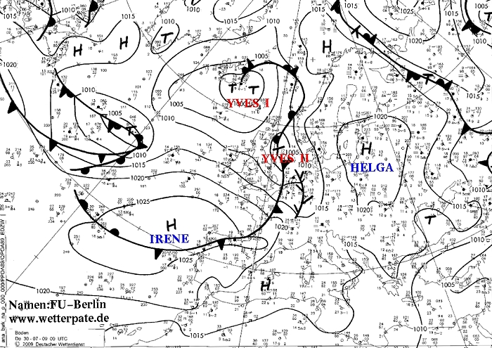
Surface analysis of July 30 at 0200 CET. Cold front near Belgian coast,
moving northeastwards. (Source chart: DWD)
|
 |
|
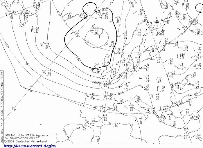
Upper air analysis 500 hPa of July 30 at 0200 CET. Relaxing upper trough
approaching the Benelux. (Source chart: DWD via wetter3)
|
 |
|
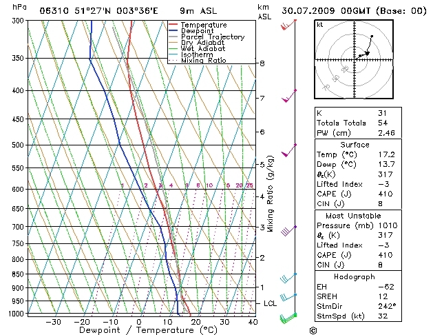
Forecasted sounding of Vlissingen of July 30 at 0200 CET. An unstable
layer from 900 hPa (1 km) till 350 hPa (8 km). (Source: Weeronline)
|
30/07/2009 0045-0300 CET. Satellite loop in the infra-red channel. The cell pointed with red arrow is the one described below with some pictures. (Source sat picture: Eumetsat via Sat24.com)
|
Radar loop between 0105-0245 CET. The echo's offshore the Belgian Coast are the ones pictured below. Some discharges took place in the cells with orange reflectivity. Tops of showers (not shown) went up to around 8 km. (Source radar picture: Belgocontrol)
|
 |
|
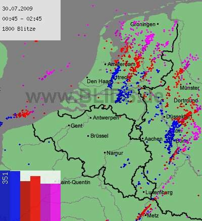
30/07/2009. Lightning sequence between 0045-0245. (Source: blids)
|
 |
|
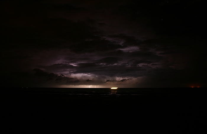
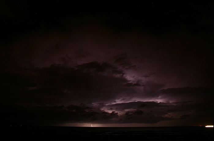
30/07/2009 0152 W. Even at a distance of at least 35 km, the sound of the
mostly CG discharges were quite loud. Stripe of light in front was a moving fishing
boat. Light dots in corner right above are stars in clear sky. Distance
of brightest strike approx 50 km.
|
 |
|
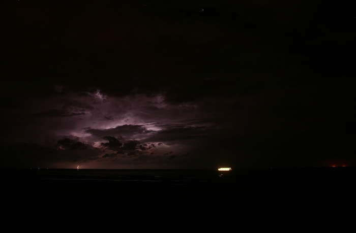
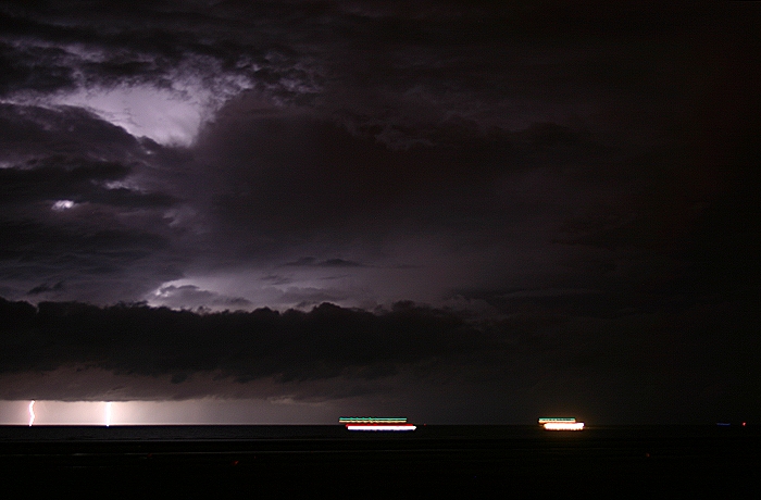
30/07/2009 0153 W. Each (couple of) minute(s) a discharge took place,
this one at a distance of approx 60 km.
|
 |
|
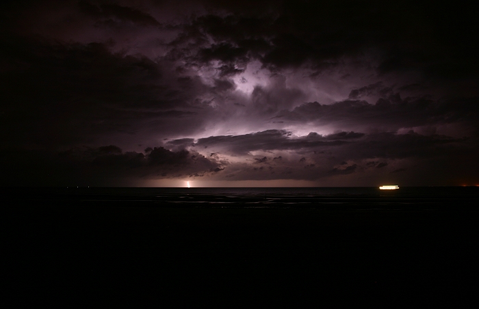
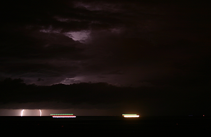
30/07/2009 0156 W. A rather bold strike, distance 50 km, also lots of IC lightning
revealing structure of surrounding cloudiness.
|
 |
|
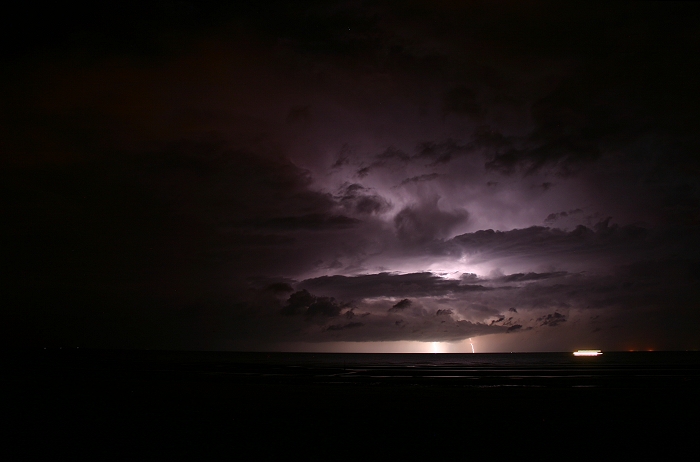
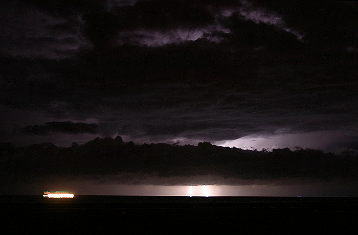
30/07/2009 0157 W. The closest discharge, distance approx 35 km.
|
 |
|
30/07/2009 0159 NW. Precipitation trails below the cloudbase became also
visible by the lightning at a distance of 50 km
|
 |
|
30/07/2009 0205 NW. After two IC strokes, another bold CG strike
(distance approx 35 km) with
behind a weaker one with at a distance of 50 km.
|
 |
|
30/07/2009 0208 NW. Last three shots have been zoomed in, distance of
these impacts was approx 35 km.
|
 |
|
30/07/2009 0210 NW.
|
 |
|
30/07/2009 0214 NW. Final shot ending the story of this cell as
afterwards only a couple very far distant (approx 80 km) lightning was
seen of another cell.
|