| Weather pictures & report of December 17 2009 |
| Snow related to small Northsea low. |
| Synopsis: at 500 hPa Omega shape pattern with the ridge over the Atlantic Ocean and sharpening upper trough over the continent. In the northeasterly upper flow a shallow depression with wrapped around frontal system glided from Denmark via the coast of the Low Countries to northwestern France. T850 hPa was around -7°C, and at all upper levels the temperature remained negative. Consequently, precipitation was in solid form affecting the northwest, but mainly center of Belgium. All pictures were taken at Kampenhout (central Belgium), hours in local time (CET). |
 |
|
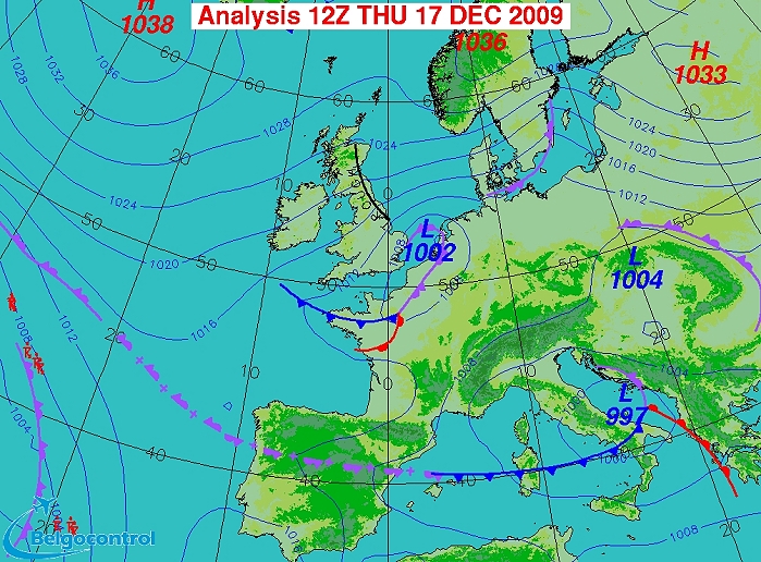
Surface analysis of December 17 2009 at 1300 CET. Small low centered
west of Holland moving southwestwards. At that time, its associated occluded front
affected western parts of the Benelux. (Source chart: Belgocontrol)
|
|
Loop of 4 surface analyses (of 13, 16, 19 and 24 CET) with weather plots
showing the movement of the depression and associated wintry
precipitation belt. (Source:
meteocentre.com)
|
 |
|
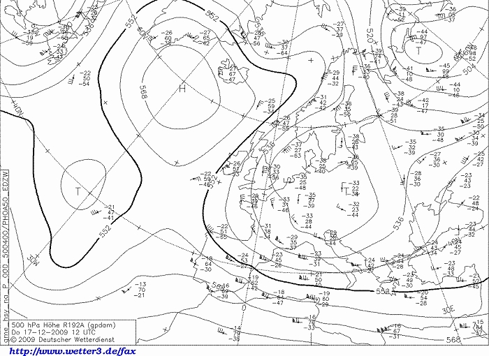
Upper air analysis 500 hPa of December 17 2009 at 1300 CET. Our region
close to the sharpening upper trough (cut-off low) over the continent. (Source chart: DWD via wetter3)
|
 |
|
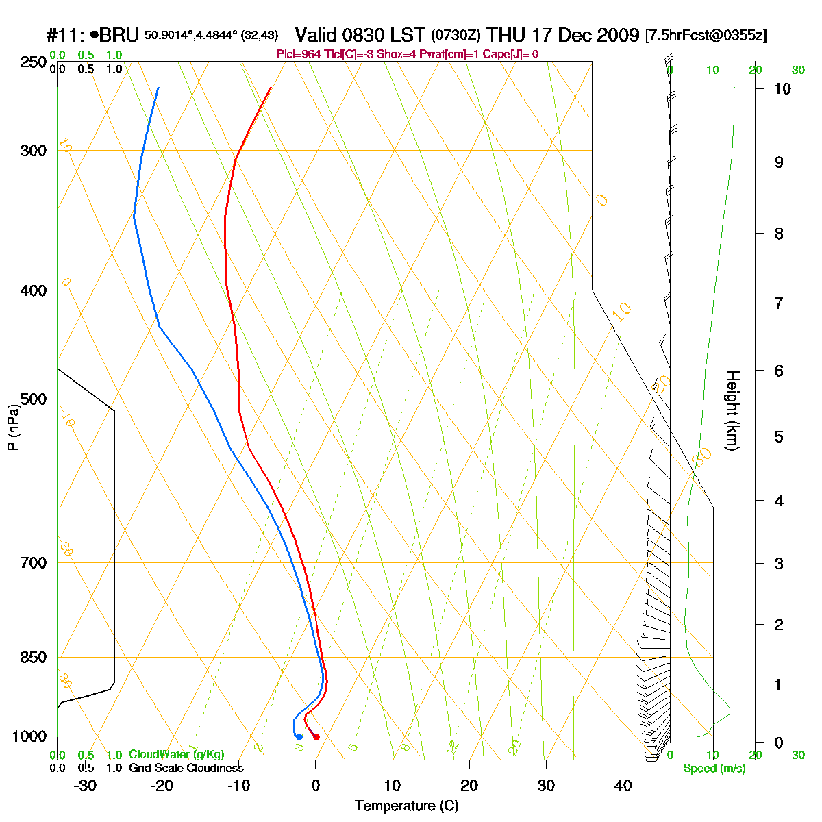
Loop of forecasted soundings for Brussels of December 17 2009 between
0830-1900
CET. Temperature only at the bottom layer reaching the freezing point
with all above subzero values, saturated up to 500 hPa. (Source:
RASP)
|
|
Another loop of forecasted soundings for Brussels of December 17-18 2009 between
0700-0400
CET. Added info in this loop is that during the evening and night, as
the depression moved further southwards, the wind direction changed at
all levels to the easterlies advecting cold air. (Source:
weatheronline.co.uk)
|
17/12/2009 1245-1515 CET. Satellite loop in the visible channel. Inland lots of frontal stratiform cloudiness which moved around the small vortex west of Holland. Above the Northsea clear indication of cumuliform cloudiness due to the warmer sea surface. (Source sat picture: Eumetsat via Sat24.com)
|
 |
|
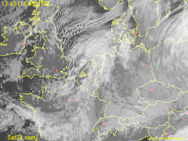
17/12/2009 1745-1930 CET. Satellite loop in the infra-red channel. The stratiform layer was
trailing over the center of Belgium,
before moving again westwards later that evening and night. It had of
course a serious impact on the amount of snowfall over this area. (Source sat
picture: Eumetsat via Sat24.com)
|
Radar loop (reflectivity in dBZ, with corresponding precipitation rate) of December 17-18 2009 between 1020-0300 CET. The rather small precipitation band moved slowly eastwards, later stationary before moving westwards. (Source radar picture: Belgocontrol)
|
Some metars (hours in UTC) of Brussels Airport (EBBR). Translation: copy paste each obs via metar-decoder
|
|
Time lapse of webcam images between 1240-1641 CET showing how an
accumulation of 9 cm was formed during the afternoon. Later during the
evening and night another 6 cm came down on the returning occlusion.
|
 |
|
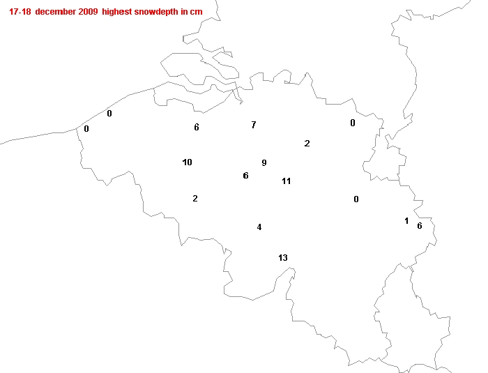
17-18/12/2009. Official snow heights (cm) in Belgium (highest values
were taken from different synops as not all stations gave snow info on
the same hours). In my garden an accumulation of 15 cm was measured, a
bit further to the southeast (regio Leuven) even values of around 20 cm
were observed. At the coast accumulation of less than 1 cm took place,
over the provinces of Limbourg, Liège and Luxembourg it stayed most of
the time dry.
|
 |
|
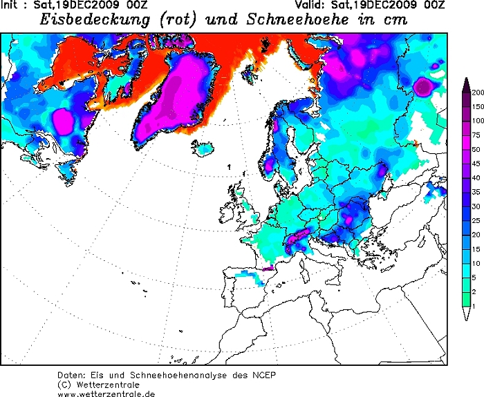
20/12/2009. On a larger scale, there was a cover of snow in almost
entire western and central Europe. (Source: wetterzentrale)
|
 |
|
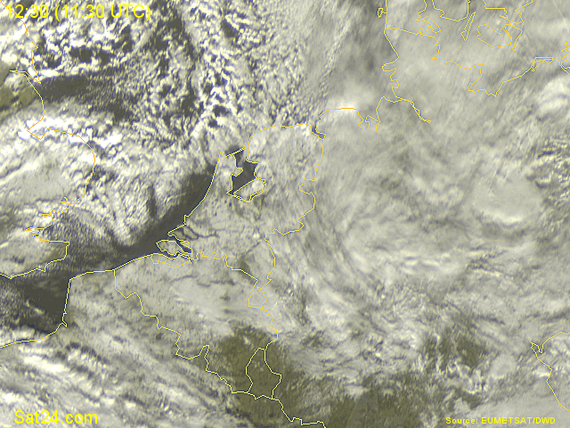
18/12/2009 1230-1415 CET. Satellite loop in the visible channel. The
next day, with some large breaks, an eye could be laid on the snow
cover. For once, no joy over the east and southeast of Belgium. (Source sat
picture: Eumetsat via Sat24.com)
|
 |
|
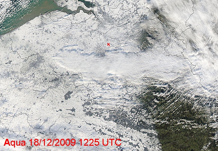
The Aqua satellite gave a closer inspection of the situation over
Belgium. Sadly a small cloud band over the south and partly
east of Belgium is present. My location at the red "K" from which a few
wintry pictures where taken. (Source: Image courtesy of MODIS Rapid
Response Project at NASA/GSFC)
|
 |
|
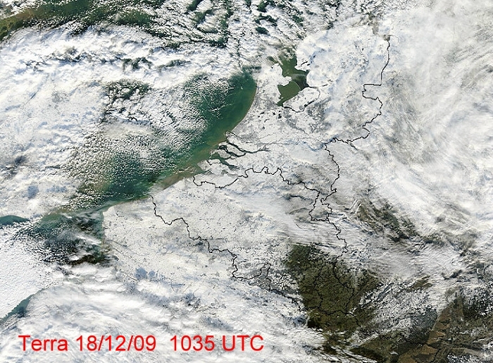
The Terra satellite giving a wider view about the snow deposit in the
Low Countries. (Source: Image courtesy of MODIS Rapid
Response Project at NASA/GSFC)
|
 |
|
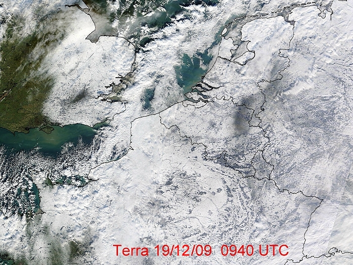
The Terra satellite of December 19 giving a view about the snow deposit
over Northwest-Europe. Watch the "dark stripe" over province of Limbourg,
this due to the lack of snow. (Source: Image courtesy of MODIS Rapid
Response Project at NASA/GSFC)
|
 |
|
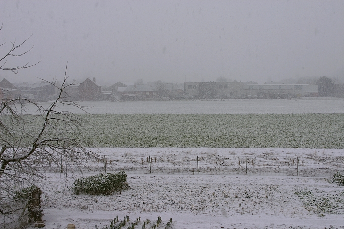
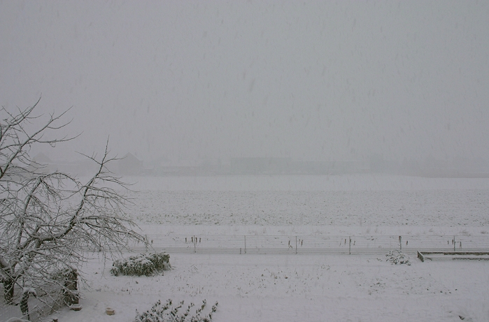
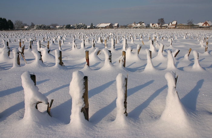
17/12/2009 1336 NNW. From noon snow began to fall gradually forming a cover.
|
 |
|
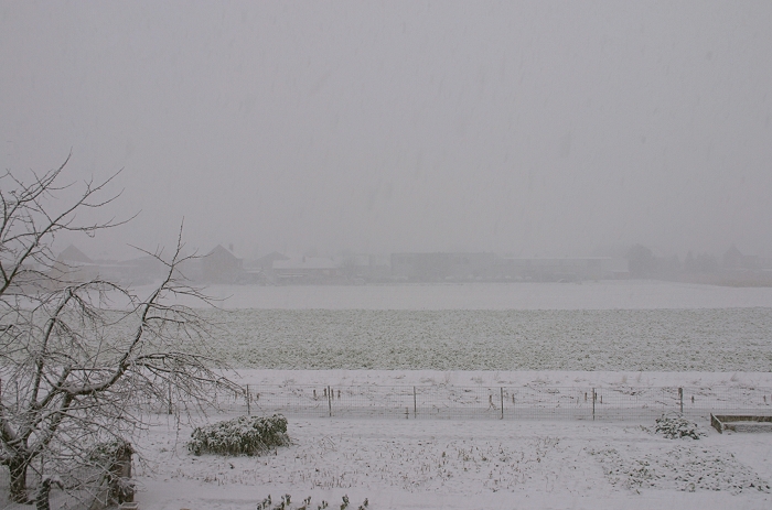
17/12/2009 1406 NNW. Half an hour later.
|
 |
|
17/12/2009 1434 NNW. Half an hour later.
|
 |
|
17/12/2009 1511 NNW. Half an hour later.
|
 |
|
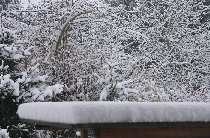
17/12/2009 1552. When the snow eased off (for a first time), this was
the result.
|
 |
|
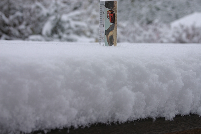
17/12/2009 1557. Proof of 9 cm.
|
 |
|
18/12/2009 0110. After the snow eased off for a second time,
this was the result. A measurement on the table gave 15 cm.
|
 |
|
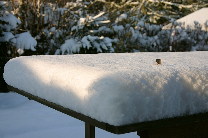
18/12/2009 1015. Next day, slightly collapsed, proof of 14 cm (stick has
a length of 15 cm).
|
 |
|
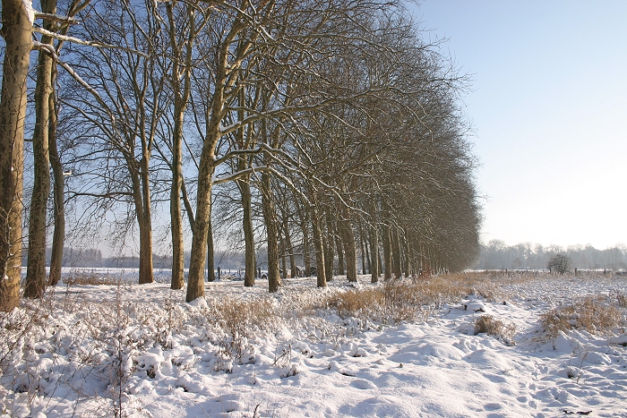
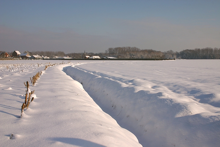
18/12/2009 1055 ENE. A walk in the park "Den Dreef".
|
 |
|
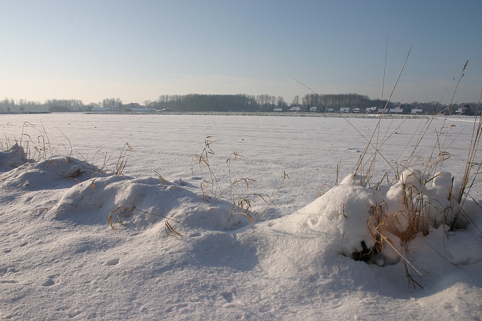
18/12/2009 1056 SW.
|
 |
|
18/12/2009 1101 W.
|
 |
|
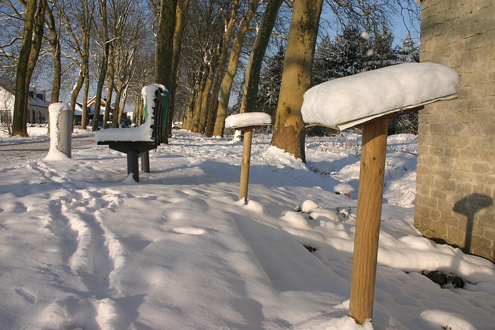
18/12/2009 1112 N.
|
 |
|
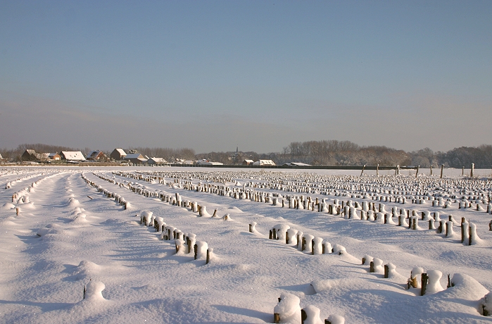
18/12/2009 1116 N.
|
 |
|
18/12/2009 1121 W.
|
 |
|
18/12/2009 1128 E.
|
 |
|
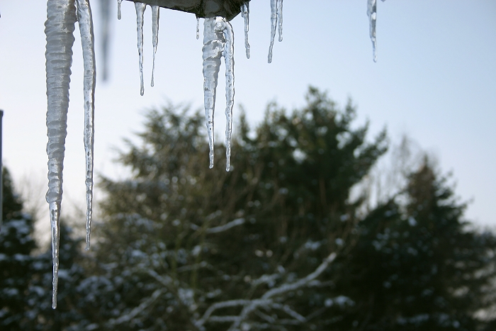
18/12/2009 1427. With further descending temperatures, some malfunctions
of the roof became visible.
|
 |
|
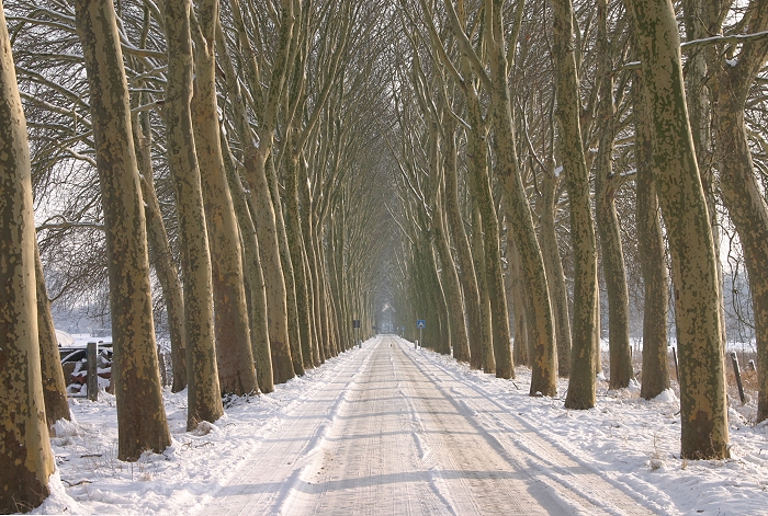
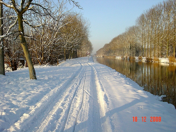
18/12/2009. Via another habitant of Kampenhout some shots became available from the nice scenery near "Het SAS" ( Kanaal between Leuven
and Mechelen).
|
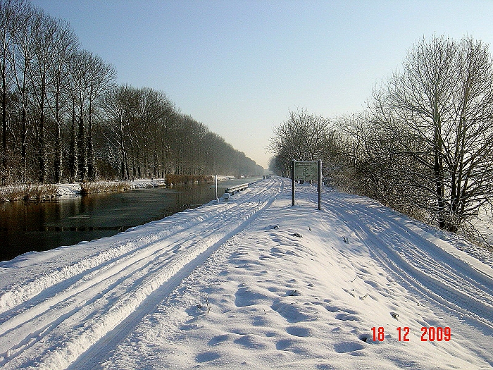 |
| 18/12/2009. Here another shot, last two ones © Kevin Van Camp. |