| Weather pictures & report of January 9 2010 |
| Blowing and drifting snow related to upper air warm front. |
| Synopsis: at 500 hPa a cut-off low centered over the continent with wrapped around an upper air warm front reaching the Benelux. It produced for 12 hours light blowing (afterwards drifting) snow adding a couple of cm on the already present white blanket which was formed on January 3 2010. All pictures were taken at Kampenhout (central Belgium), hours in local time (CET). |
 |
|
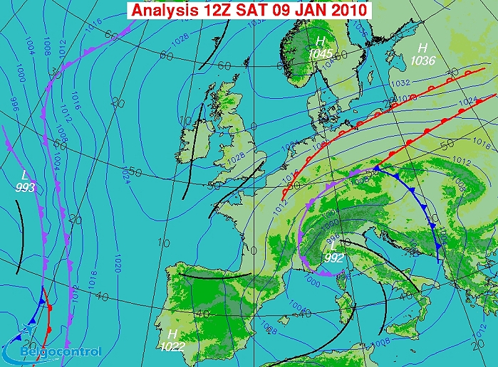
Surface analysis of January 9 2010 at 1300 CET. Anticyclone centered
over Scandinavia, depression centered over
northern Italy with our area in a strong northeasterly flow. Related to
the depression an occlusion preceded by an upper air warm front. Latter
feature produced for 12 hours light falls of (blowing) snow. (Source chart: Belgocontrol)
|
 |
|
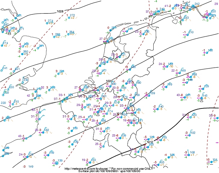
Surface analyses of 1000 CET with weather plots showing the broad wintry
precipitation belt. Of importance are the gusts (in pink color) with
values between 23-33 kt resulting in light blowing and drifting snow. (Source: meteocentre.com)
|
 |
|
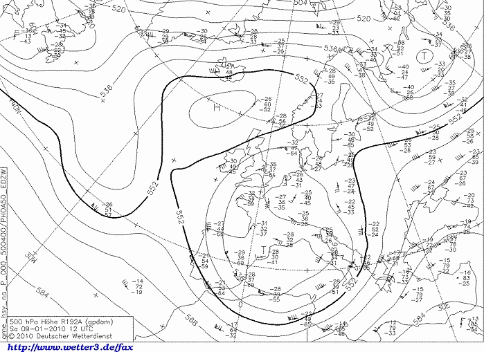
Upper air analysis 500 hPa of January 9 2010 at 1300 CET. Cut-off low
centered south of France with a trough extending to the Low Countries.
It was blocked by the ridge north of it. At the cold pools (north)eastern
side milder air was advected in the upper levels. Between the cold and
warm air a precipitation belt was formed, without significant milder
temperatures on the ground, so it was indicated on the surface map as an
upper level warm front.
(Source chart: DWD via wetter3)
|
 |
|
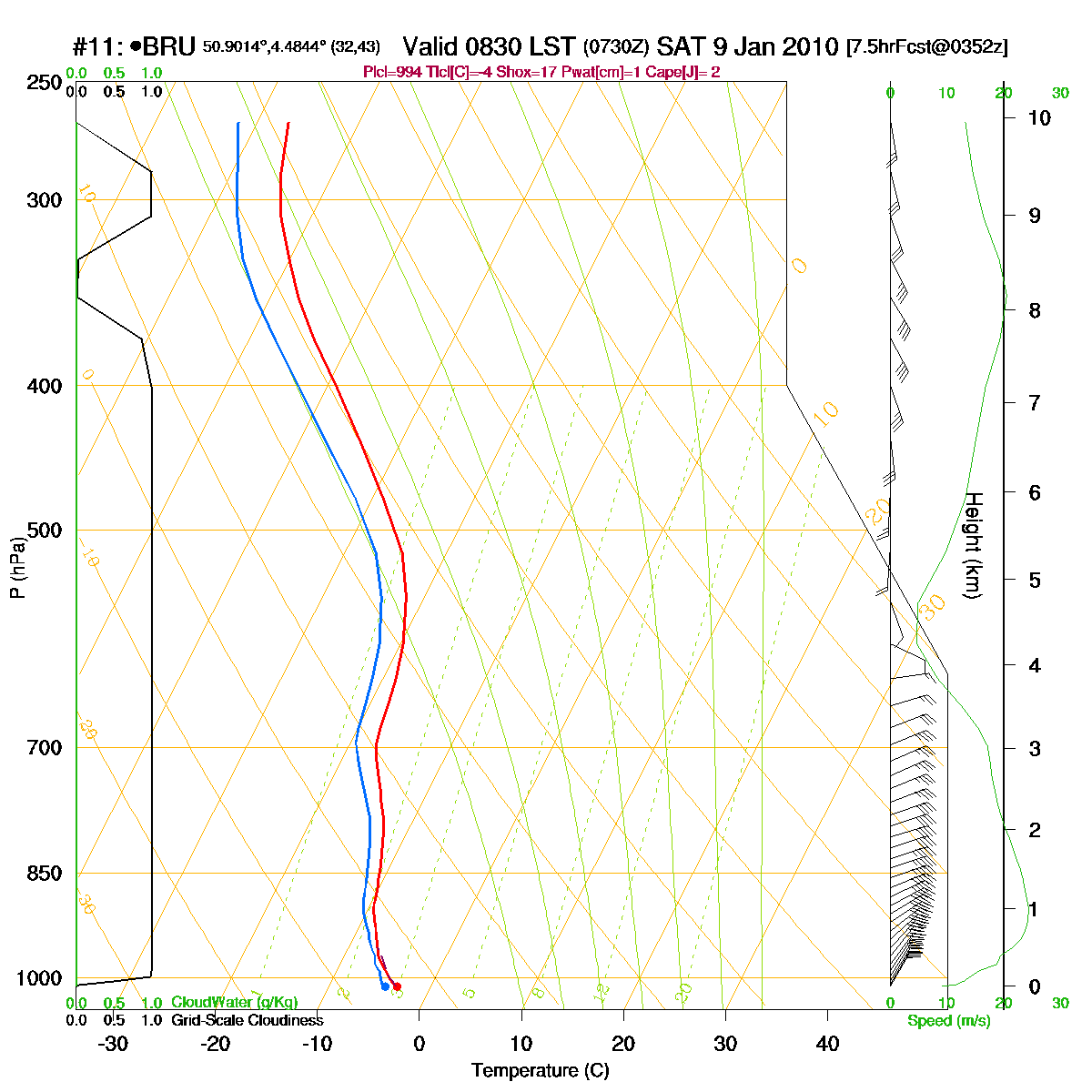
Loop of forecasted soundings for Brussels of January 9 2010 between
0830-1900 CET. Entire layer saturated with subzero temperatures, so
possible precipitation is 100% under solid form. (Source: RASP)
|
|
Another loop of forecasted soundings for Brussels between January 9 2010
0400 CET and January 11 2010 1900 CET in steps of three hours. It shows
over the entire period an almost saturated layer which gradually becomes
warmer in the upper levels. It resulted in 36 hours of intermittent
light falls of snow(grains). (Source: weatheronline.co.uk)
|
 |
|
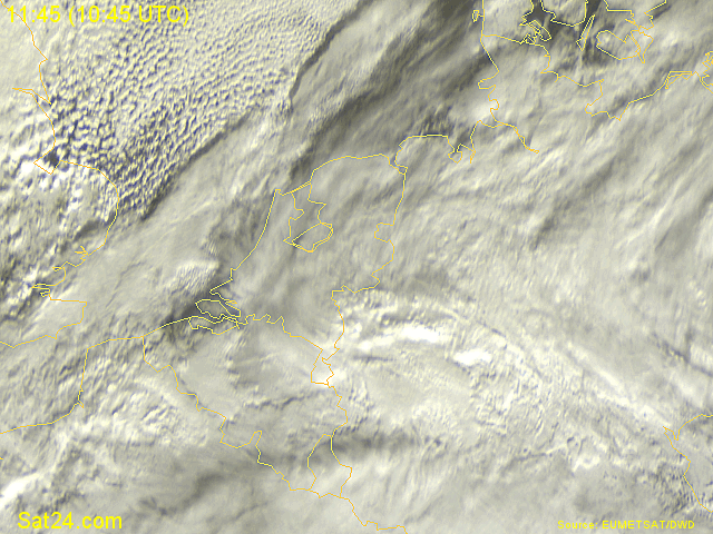
09/01/2010 1145-1330 CET. Satellite loop in the visible channel showing
a mass of stratiform cloudiness over the southern parts of the Benelux.
Over Holland thinner cloudiness (Cirrus) is present giving a glimpse on
the already present snow cover. (Source sat picture: Eumetsat via
Sat24.com)
|
 |
|
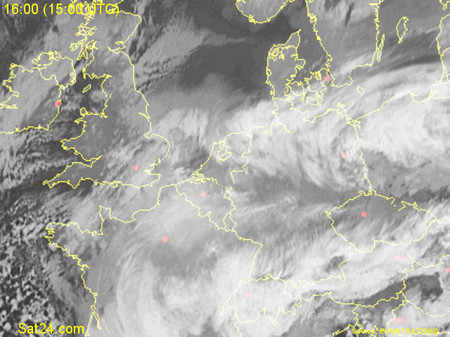
09/01/2010 1600-1700 CET. Satellite loop in the infra-red channel
showing a huge cloud canopy over a large part of Europe. (Source sat
picture: Eumetsat via Sat24.com)
|
Radar loop (rainfall rate in mm/hr) of January 9 2010 between 0800-1640 CET. A rather small and not so intense precipitation belt trailed for quite a while over the northeast and center of Belgium giving 3 to 5 cm of fresh snow, before moving westwards while weakening. (Source radar picture: Belgocontrol)
|
Some metars (hours in UTC) of Brussels Airport (EBBR). Translation: copy
paste each obs via
metar-decoder
|
|
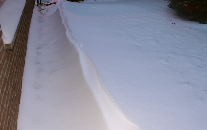
Time lapse of webcam images between 1055-1500 CET showing how the
(blowing) snow added 4 cm to the already present 3 cm. Against the wall
also the formation of a snow dune with a height of 30 cm.
|
 |
|
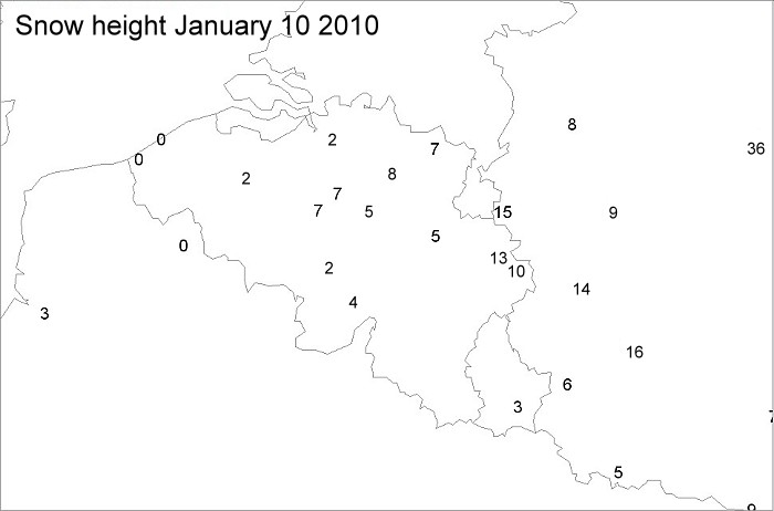
Snow height (highest values in cm) from the official meteo stations
based on some synops taken from different hours. In my garden also 7 cm
was accumulated.
|
 |
|
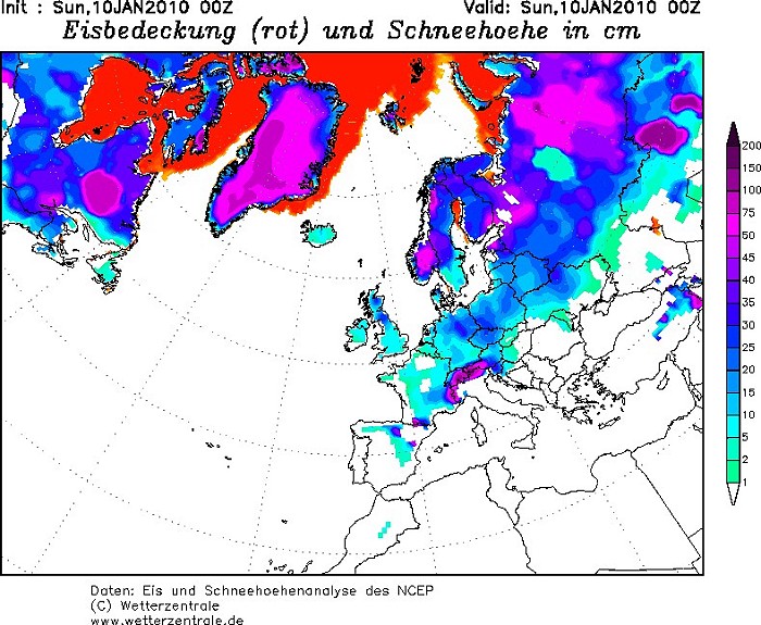
Snow heights in a wider perspective showing large parts of Europe
(including the U.K. !!!) under a white carpet. This was the climax of a
ten day cold wave as afterwards gradually warmer air was advected into
Europe. (Source: Wetterzentrale)
|
 |
|
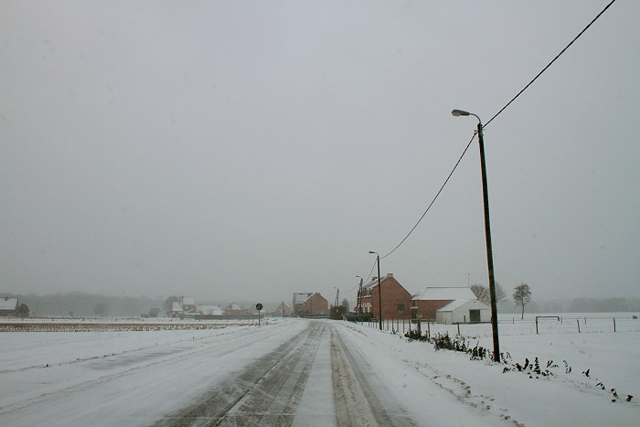
09/01/2010 1145 W. A small drive produced some interesting shots with
blowing snow on the street.
|
 |
|
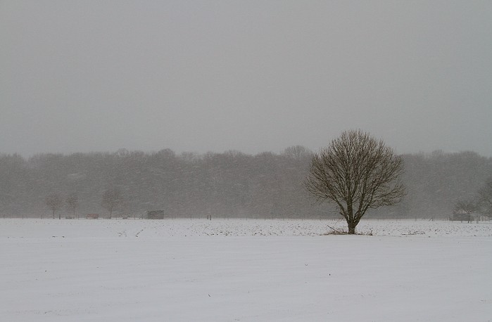
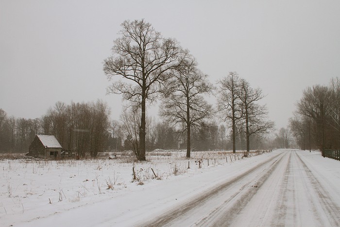
09/01/2010 1147 NW. Lonely tree in front a small forrest.
|
 |
|
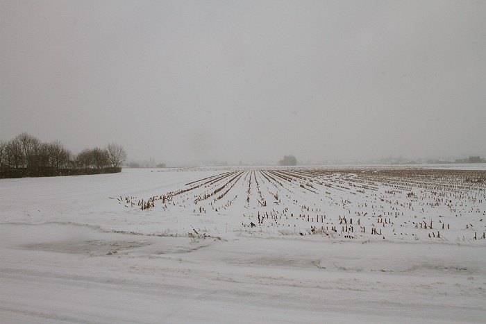
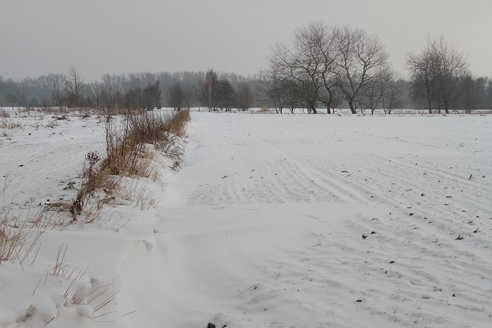
09/01/2010 1149 SSE. View into the fields
|
 |
|
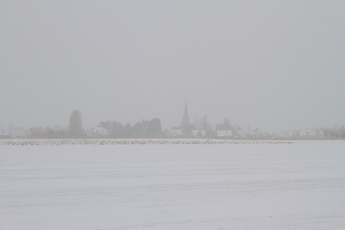
01/09/2010 1154 E. In the back, at a distance of 1 km, the church
of Kampenhout barely visible.
|
 |
|
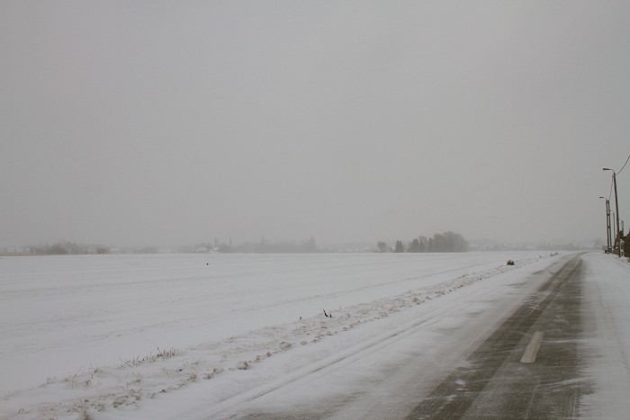
09/01/2010 1155 SE. Another view on the road.
|
 |
|
09/01/2010 1218 NE. Nice wintry scenery.
|
 |
|
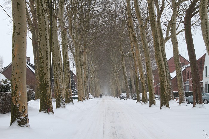
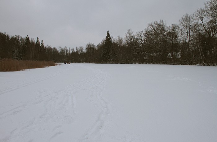
09/01/2010 1431. Den dreef is always a pleasure to have a wintry walk.
|
 |
|
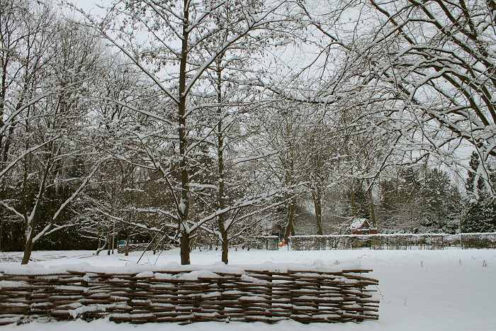
09/01/2010 1533. Trees covered by a nice wintry coat.
|
 |
|
09/01/2010 1546. The pool was frozen with on top of it 7 cm snow.
|
 |
|
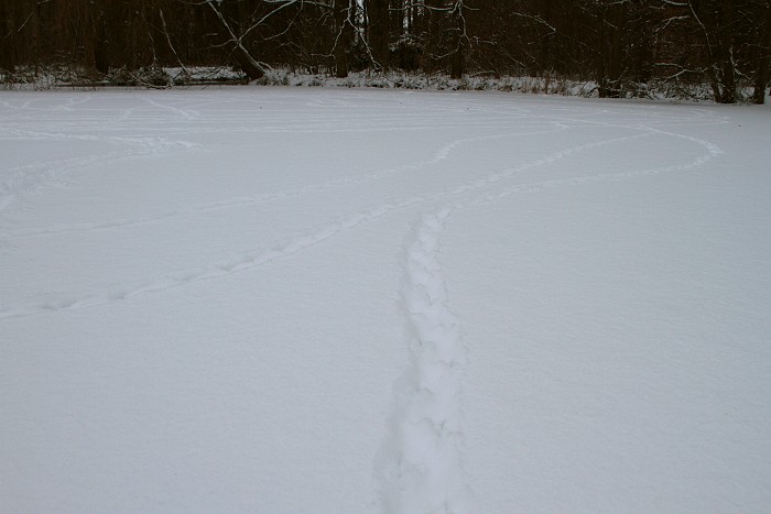
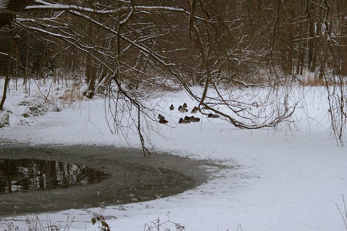
09/01/2010 1558. Footprints...
|
 |
|
09/01/2009 1607 ...of a bunch of ducks, now resting.
|
 |
|
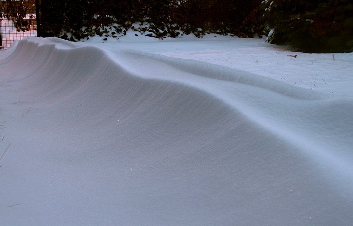
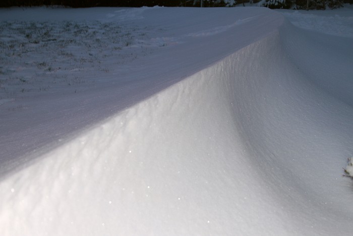
09/01/2010 1711. In the garden a couple snow dunes were formed: height
was 30 cm.
|
 |
|
09/01/2010 1713 NE. View from the top.
|
 |
|
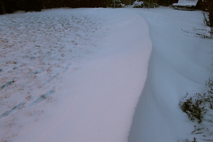
09/01/2010 1716. Bit further in the garden, the same result: this banana
shaped dune had a length of more than 15 meters, here showing half of
it.
|
 |
|
09/01/2010 1718. Wider view from the top. On the left hardly snow on the
grass, on the right most of it accumulated on the dune. This was
undoubted the symbol of the ten day cold wave.
|
 |
|
10/01/2010 1346 NNE. Next day, a couple more pictures were taken.
|
 |
|
10/01/2010 1348 SSW. Opposite view, how matter how hard the sun tried to
do her best, it was a sunless four day period and afterwards (from
January 13 onwards) a slow thaw
began.
|