| Weather pictures & report of June 7 2012 |
| Multicell & tornadic supercell thunderstorms along cold front. |
| Synopsis: at 500 hPa, Belgium east of a cut off low in a rather strong SW flow. During the period consecutive passage of warm front, cold front and trough line. Along the cold front some showers did develop in a rather strong shear environment. During the evening, it lead to a supercell storm over the south(east) of province Limbourg with briefly even the touch down of a weak tornado (F1). At my location (center of Belgium), also some chaotic skies could be detected, however the directional shear was somewhat weaker and only some weak multicells could develop. All pictures were taken at Kampenhout (central Belgium), hours in local time (CET). |
 |
|
Surface analysis of June 7 2012 at 2000 CET. Steering feature is a
depression centered over Wales. In the SW'ly the associated warm front
crossed Belgium in the first part of the day, the cold front followed
during the second part. This cold front was in fact positioned on a showery line,
see another version below. (Source chart: Belgocontrol)
|
 |
|
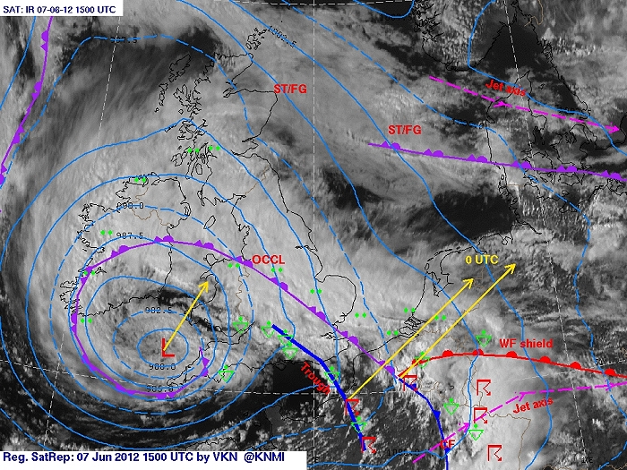
Surface analysis of June 7 2012 at 1700 CET. Second version of the
surface analysis with aid of satellite: the triple point would cross the
centre of Belgium, behind a trough line with some scattered showers.
This version seems the most close to the things that happened on the
field. (Source chart: KNMI)
|
|
Loop of 7 surface analyses of June 7 2012 (of each hour between 1600 - 2200 CET) with
weather plots. (Source: meteocentre.com)
|
 |
|
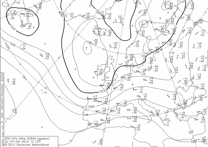
Upper air analysis 500 hPa of June 7 2012 at 1400 CET. Cut off low
between Ireland - Iceland. A weak mobile ridge crossed Belgium in a
strengthening SW flow during
the day. The relaxing trough crossed Belgium the next day. (Source chart: DWD via wetter3)
|
 |
|
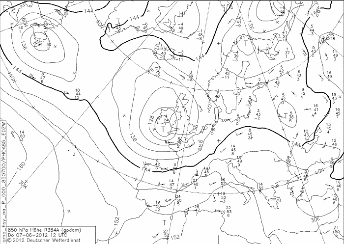
Upper air analysis 850 hPa of June 7 2012 at 1400 CET. Recognizable
again the cut off low near Ireland, Belgium in a moderate SW flow
advecting mild air
(10°C). (Source chart: DWD via wetter3)
|
 |
|
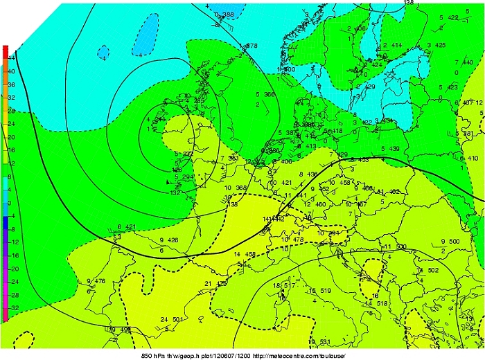
Upper air analysis 850 hPa of June 7 2012 at 1400 CET. Here we take a
look at Tw at 850 hPa, with a tongue of warm moist air moving towards
the Ardennes with overthere Tw that would reach almost 16°C. (Source chart: Meteocentre.com)
|
 |
|
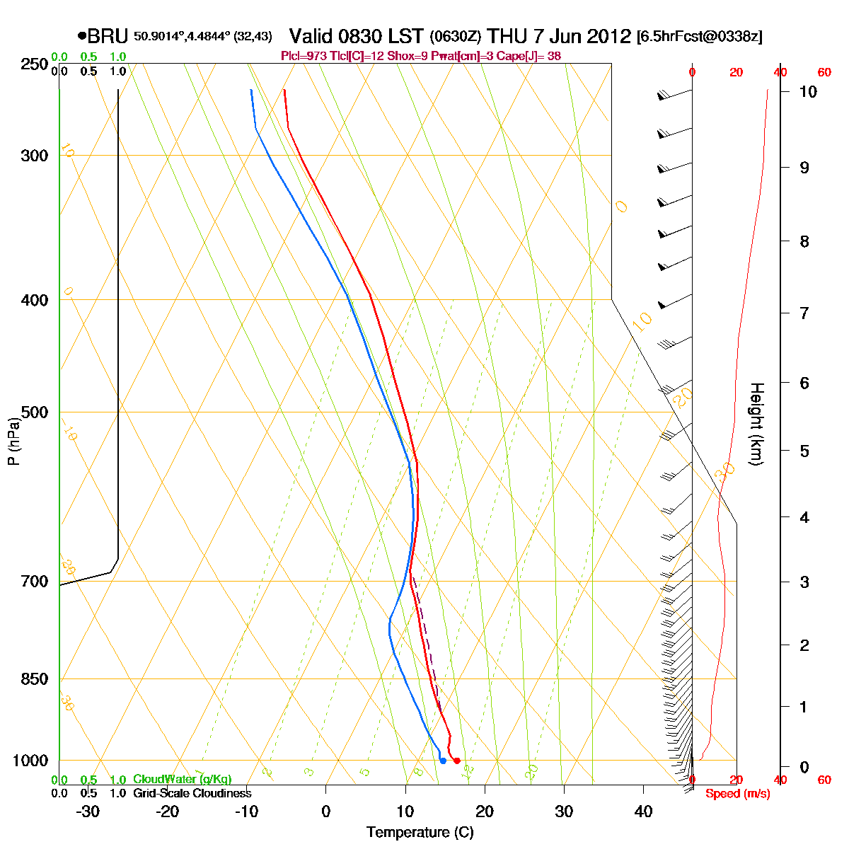
Loop of forecasted soundings for Brussels of June 7 2012 between
0830-2000 CET. A large part of the period some low level instability was present
till around 3 km height. By the end of the period this instability
reached up to 8 km, although much drier air came in. Detect also the
rather strong shear (speed and directional). (Source: RASP)
|
|
Another loop of forecasted soundings for a 12 hours period (in steps of
three hours) of Brussels from June 7 2012, 1100 CET onwards. Included
are some thunderstorms indices: surface based CAPE went up to almost 700 J/kg, KI
31, TT
50, LI -3 = moderate convective potential which may lead to scattered
thunderstorms. The SREH of 120 m²/s², in combi with the not
too strong CAPE, the environment would be favorable for multicell
thunderstorms. (Source: weatheronline.co.uk)
|
 |
|
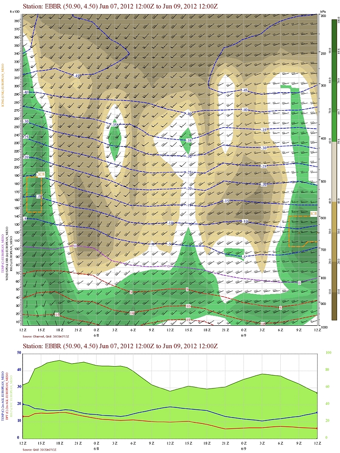
Forecasted vertical profile and surface temperature for Brussels Airport
of June 7 from 1400 CET and the following 48 hours. Legend of upper map: green-brown-white
is humidity in steps of 10% with darkest green being 90% or more, wind
in kt, temperatures each 5°C. From the start humid air well towards the
upper levels (200 hPa). Late afternoon drier came in from the highest
levels. First six hours
also significant shear in direction (and speed). (Source: Belgocontrol)
|
 |
|
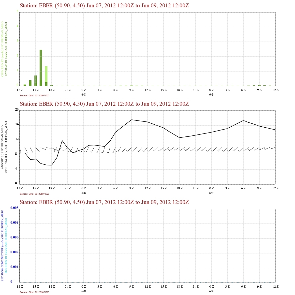
Forecasted precipitation, 2 meter temperature for Brussels Airport of
June 7 from 1400 CET and the following 48 hours. Legend: precipitation
darkest green = dynamical rain, light green is convective rain. Wind in
kt. Dynamical rain started in afternoon ending with convective character
towards 1800 UTC. The wind veered remarkable just after 1800 UTC. (Source: Belgocontrol)
|
|
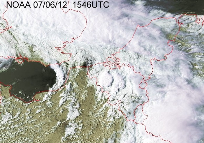
07/06/2012 1915-2115 CET. Satellite loop in the visual channel.
Sharp edged storms are recognizable. (Source sat
picture: Eumetsat via Sat24.com)
|
 |
|
Still satellite picture in the visual channel where over Belgium some
deep convection was taking place. (Source: NOAA via University of Bern)
|
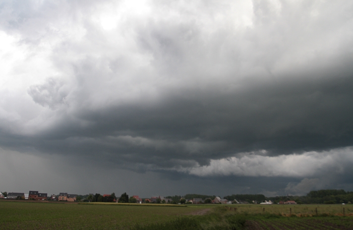
Radar loop (rainfall rate in mm/hr) of June 7 2012 between 1600-2230 CET. The precipitation started as dynamical character but ended convective. Around 1700 UTC it resembles over the center as a bow echo, as shown a bit further in the photos and time lapse on the field, there was at that moment a quite turbulent character of the cloudiness present. At 1740 UTC, over Limburg, there was briefly a supercell with hook echo in which a weak tornado was spawned, see also radar picture below. (Source radar picture: Belgocontrol)
|
 |
|
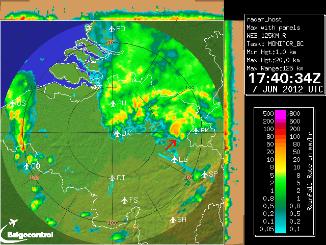
07/06/2012. Still image of the radar at 1740 UTC (or 1940 CET). The red
arrow just north of "LG" shows the signature of a hook echo. (Source picture: Buienradar)
|
 |
|
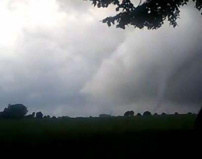
07/06/2012 around 1935 N-NW. A glimpse of the weak tornado (F1) just north of Tongeren
(in the south of province Limbourg). Source picture: "Yannick" via http://nieuws.meteovista.be)
|
 |
|
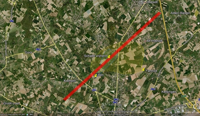
07/06/2012. Track of the tornado on a Google map based on info from
witnesses or damage. (Source picture: weerwoord.be)
|
 |
|
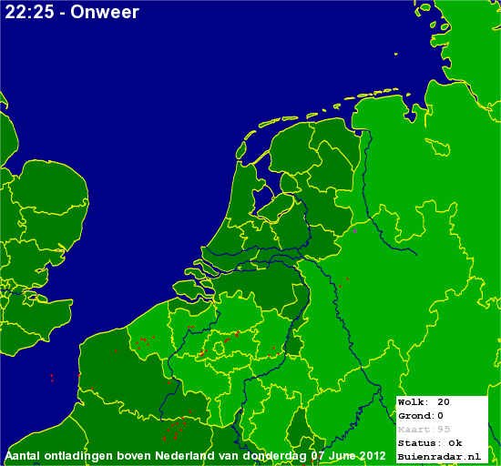
07/06/2012. Amount of discharges over the Benelux which were quite low. (Source picture:
Buienradar)
|
Some metars (hours in UTC). Translation: copy
paste each obs via
metar-decoder
Brussels Liège
201206071550 METAR EBLG 071550Z 12006KT CAVOK 20/12 Q0999
NOSIG= Maastricht
201206071525 METAR EHBK 071525Z AUTO 18008KT 150V210 9999
NSC 21/13 Q1000 NOSIG= |
 |
|
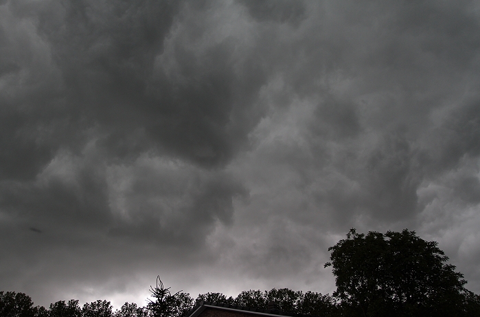
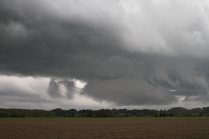
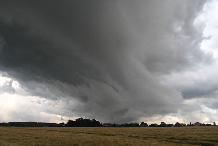
07/06/2012 1927 SSW. Some chaotic skies began to appear.
|
 |
|
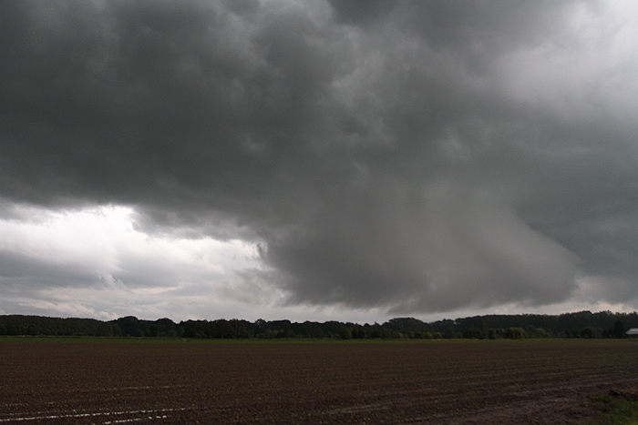
07/06/2012 1932 SE. A strange looking low cloud was of interest.
|
 |
|
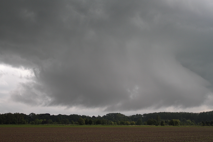
07/06/2012 1932 SE. Zooming in, the bottom part moved to the right of
this picture, while the upper part moved in opposite direction. Could
this be the start of a wall cloud with more?
|
 |
|
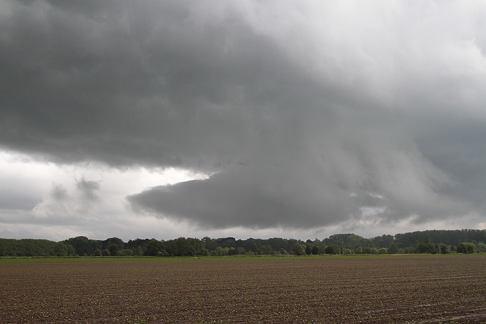
07/06/2012 1933 SE. But then it didn't as gradually it became detached from
the cloudiness above it
|
 |
|
07/06/2012 1934 SE. As evident in this picture.
|
 |
|
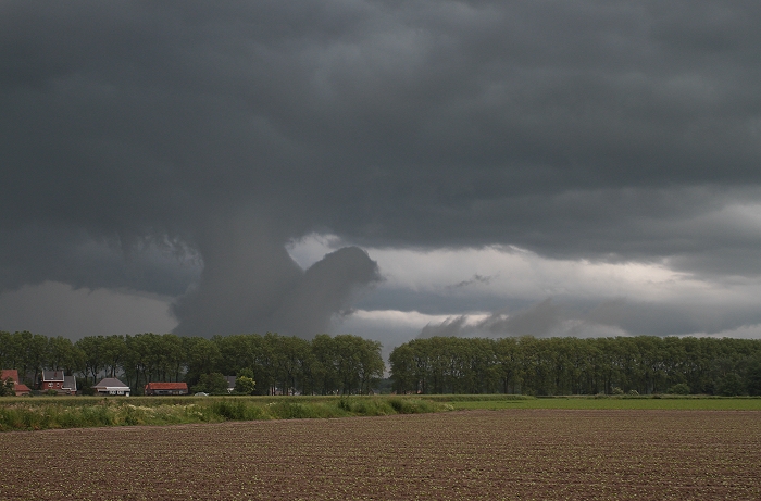
07/06/2012 1937 NE. Bit more in northeasterly direction, another strange
shaped low cloud began to appear: it resembles a bit to a chicken.
|
 |
|
07/06/2012 1938 NE. But a bit later, it seemed more to be a turtle.
Again here this cloud was boiling in every direction.
|
 |
|
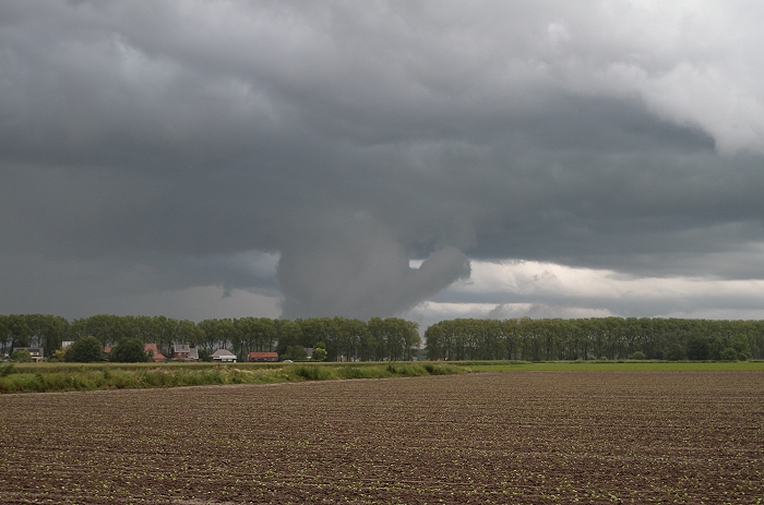
07/06/2012 1940 W. Driving a bit further, another very low cloud band
was approaching.
|
 |
|
07/06/2012 1943 SSW. Passing overhead.
|
 |
|
07/06/2012 1950 NE. Opposite direction.
|
|
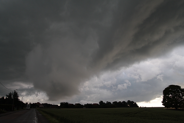
Between 1926-1946, direction N, these events were also captured in a
time lapse where clearly the turbulent character of the cloudiness is
visible.
|
 |
|
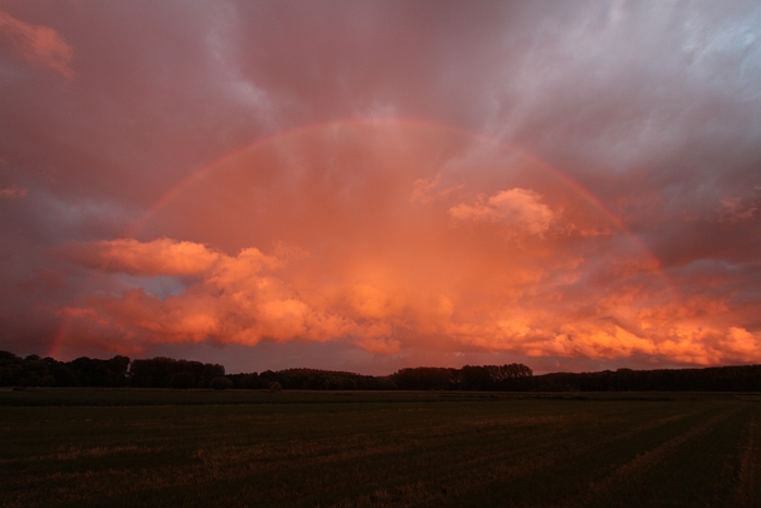
07/06/2012 2149 SE. Later a line of weak showers by with behind a
fantastic primary red rainbow.
|