| Weather pictures & report of March 28-29 2013 |
| Light snow related to a weak occlusion |
| Synopsis: at 500 hPa a cold pool over the British Isles moved over the Benelux. At surface a depression over central Europe was almost stationary with its occluded front stretching towards the Benelux. It gave during the night of March 28-29 light falls of snow from 0 to 1 cm. Pictures taken at Kampenhout. Hours in local time (CET). |
 |
|
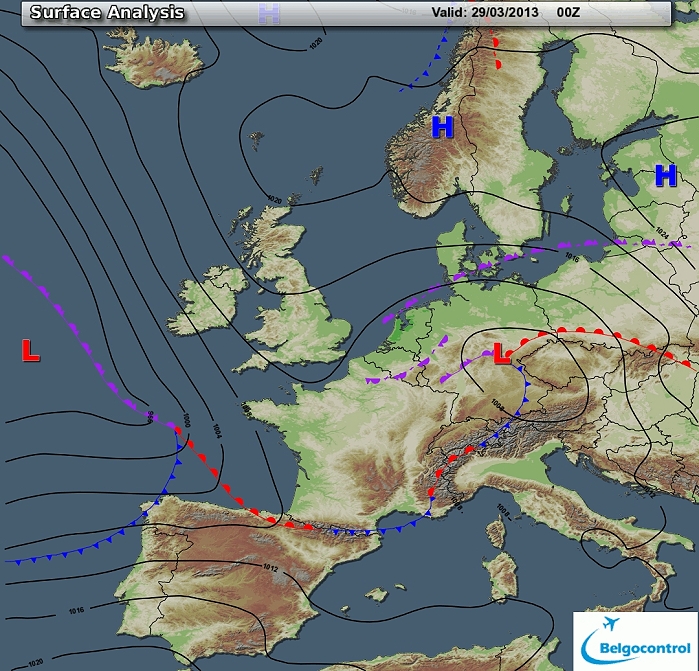
Surface analysis of March 29 2013 at 0100 CET. A persisting high
pressure cell over Scandinavia and a depression over mid Europe with
over the Benelux a cold NE'ly flow. (Source chart: Belgocontrol)
|
|
Loop of 13 surface analyses of each hour of March 28 from 1900 CET
onwards with the weather plots showing snow falling with slightly
positive temperatures, but towards midnight negative temperatures. (Source: meteocentre.com)
|
 |
|
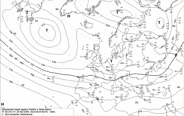
Upper air analysis 500 hPa of March 29 2013 at 0100 CET. A trough over
the Benelux which moved slowly from west to east. (Source chart: DWD via wetter3)
|
 |
|
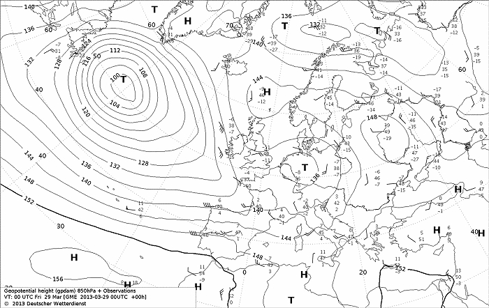
Upper air analysis 850 hPa of March 24 2013 at 0100 CET. Depression
recognizable over the Benelux which moved slowly E-wards.
Isotherm of -8°C was overhead. (Source chart: DWD via wetter3)
|
 |
|
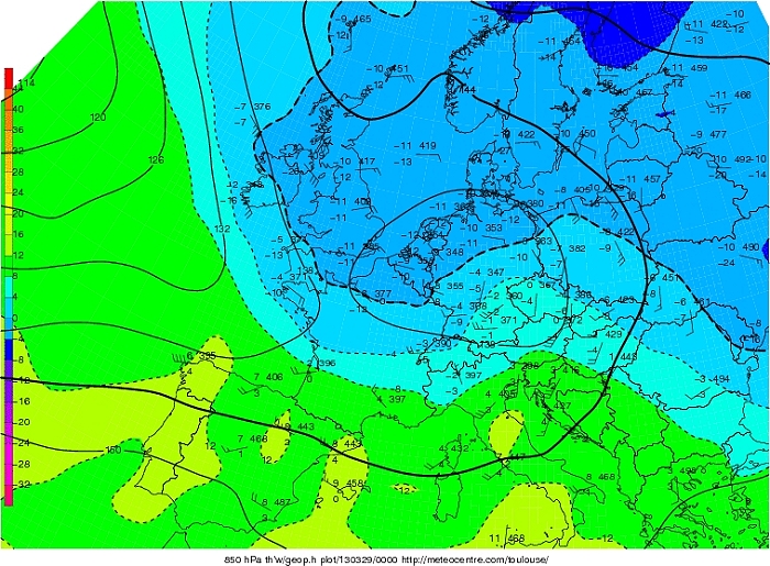
Upper air analysis Theta W 850 hPa of March 29 2013 at 0100 CET. Very
cold air with negative values was present over northern parts of Europe
spreading out SW-wards over the Benelux and the British Isles. (Source chart: Meteocentre.com)
|
 |
|
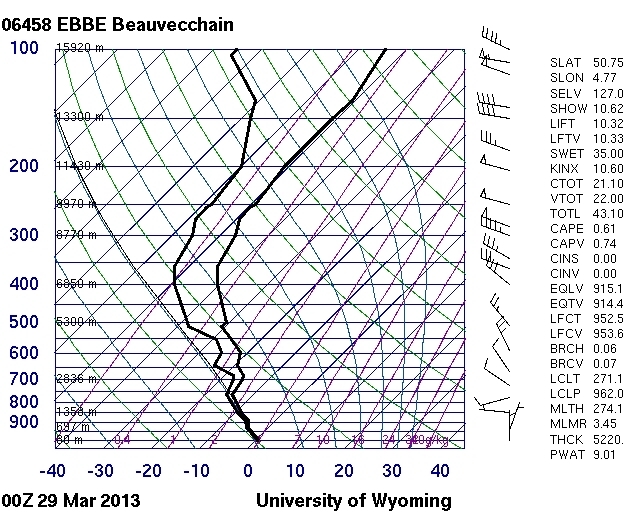
Observed sounding for Beauvechain of March 29 2013 around 0100 CET.
Negative temperatures at all levels with a small frontal inversion
around 750 hPa and furthermore well saturated till 700 hPa.
(Source: http://weather.uwyo.edu/upperair/europe.html)
|
|
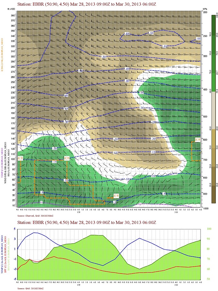
Loop of 8 forecasted soundings each 3 hour of March 28-29 2013
from 1600 CET onwards for Brussels Airport. Till late evening
temperature in the bottom layer was positive, then the entire night just
negative and again positive from the forenoon onwards. The air mass was
during late evening temporary saturated up to 700 hPa. (Source:
weatheronline.co.uk)
|
 |
|
Forecasted vertical profile and surface temperature for Brussels of
March 28 2013 from
0900 UTC (=1000 CET) and the following 48 hours in steps of 1 hour. Legend of upper map: green-brown-white
is humidity in steps of 10% with darkest green being 90% or more, wind
in kt, temperatures each 5°C. In the afternoon of March 28, the
frontal cloudiness arrived and would clear second part of the following
night. Temperature became negative towards midnight. (Source: Belgocontrol)
|
 |
|
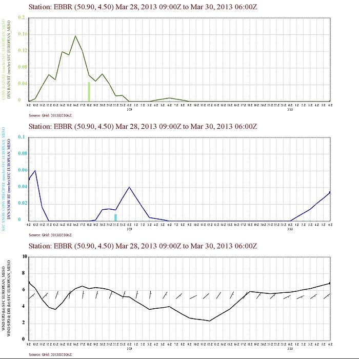
Corresponding precipitation. During the evening of March 28 wintry
precipitation would fall more and more under solid form. (Source: Belgocontrol)
|
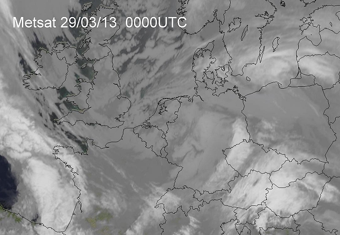 |
| 29/03/2013 0100 CET. Satellite picture
(infrared) but with color. Frontal cloudiness over northwest Europe
which tops not too high (or cold), hence the grey color.
Source picture: Eumetsat
|
Radar loop (reflectivity in dBZ) from March 28-29 2013 from 1600 CET onwards. Blue colors represents slight snow, green colors is light to moderate snow. (Source radar picture: Belgocontrol).
|
Metars (hours in UTC) of Belgian airport EBBR. Translation: copy paste each obs via
metar-decoder
EBBR 281420Z VRB01KT 9999 SCT038 BKN049 05/M05 Q1007 NOSIG=
|
 |
|
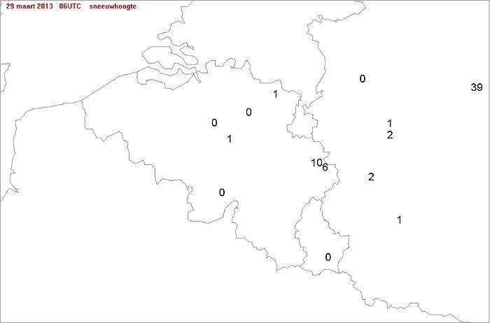
Snow height in cm taken from the synops of 0600 UTC of March 29 2013.
Top: Elsenborn with 10 cm (came from 8 cm already present
earlier). Elsewhere an accumulation between 0 and 1 cm was observed.
|
 |
|
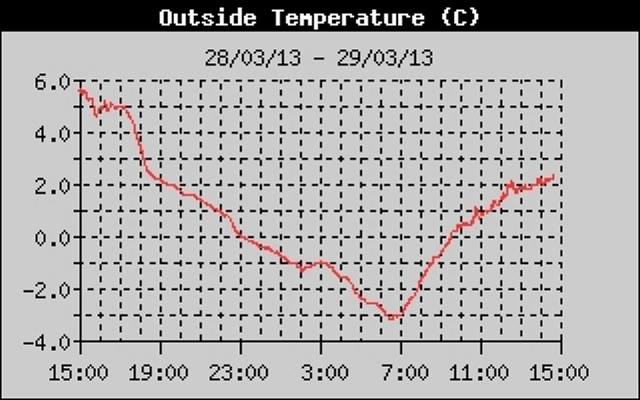
28-29/03/2013. Temperature histogram in degrees Celcius in local time (CET)
over 24 hrs taken from an automatic station at Kampenhout. From 2300
below 0°C with lowest value
-3,2°C in the morning.
|
 |
|
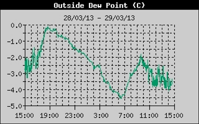
28-29/03/2013. Dewpoint temperature histogram in degrees Celcius in local time (CET)
over 24 hrs taken from an automatic station at Kampenhout. Whole period
below 0°C.
|
 |
|
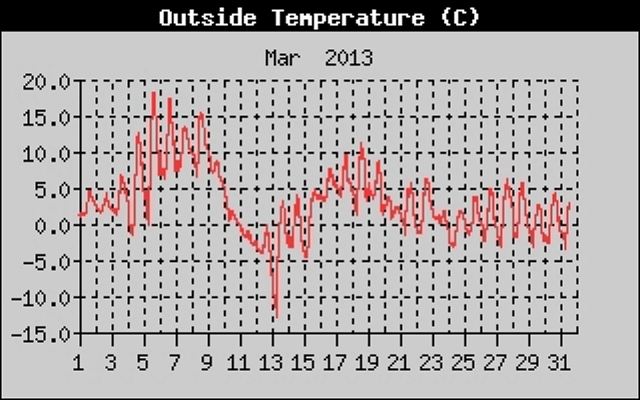
01-31/03/2013. Temperature histogram in degrees Celcius in local time (CET)
of the entire month March taken from an automatic station at Kampenhout.
Rather cold month with over half of the period nigh frost.
|
 |
|
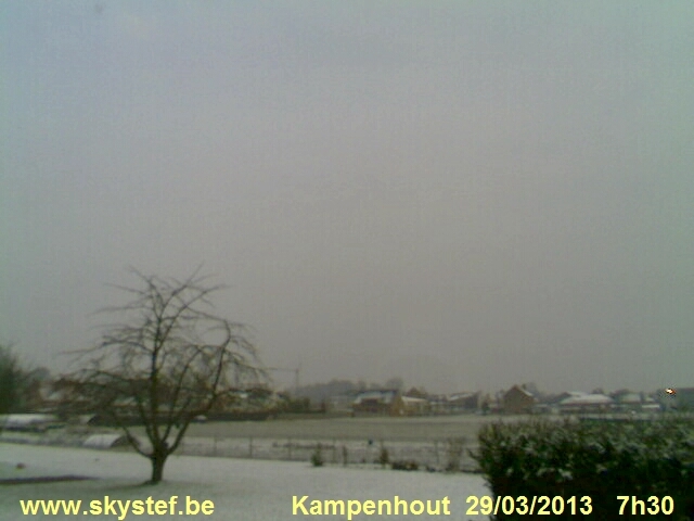
29/03/2013. Again some late snow on my weather webcam.
|
 |
|
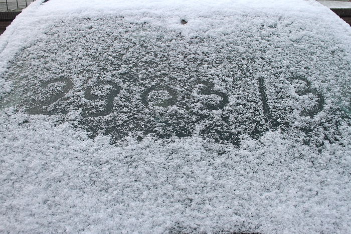
29/03/2013 0734. Proof of the date the morning after the nightly
snowfall.
|
 |
|
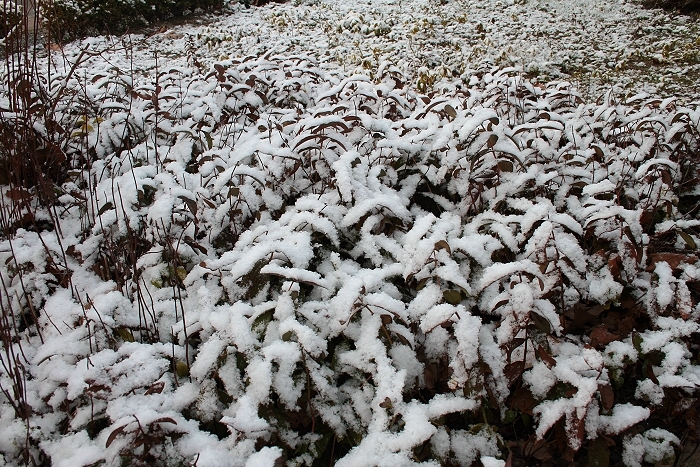
29/03/2013 0734. Plants under a thin snow cover.
|
 |
|
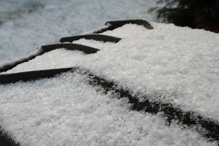
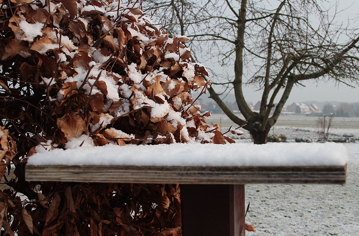
29/03/2013 0743. Detail.
|
 |
|
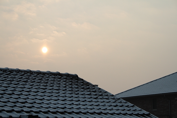
29/03/2013 0744. The sun came out.
|
 |
|
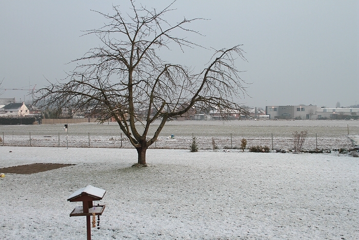
29/03/2013 0744. View into the garden.
|
 |
|
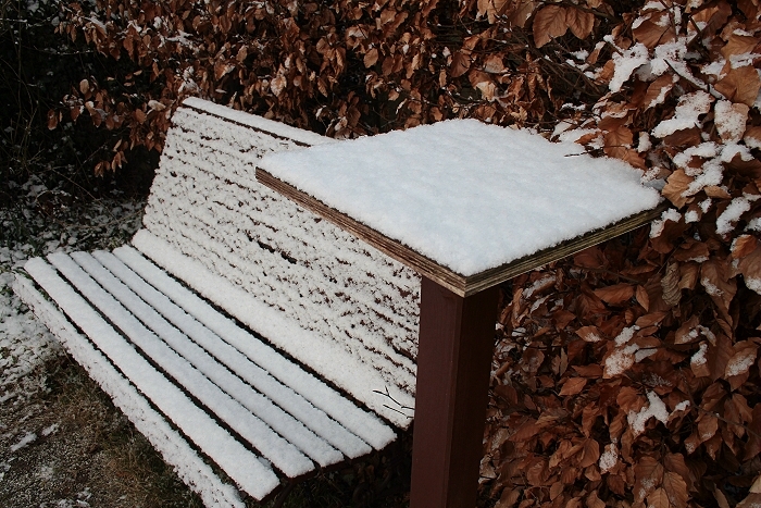
29/03/2013 0748. A thin cover of roughly 0,5 to 1 cm could be observed.
|
 |
|
29/03/2013 0750.
|