| Weather pictures & report of July 27 2013 |
| Multicell thunderstorms along convergence lines in warm sector. |
| Synopsis: at 500 hPa, Belgium east of a sharpening trough in a rather strong SSW flow. Overhead, in the warm sector, two thermal trough crossed in a time window of 12 hours. Both gave MCS thunderstorms on a squall line giving widespread shelf clouds. Pictures of the morning taken by Sebastian Verachtert at Brussels Airport, pictures of the evening taken by myself at Groenendijk (Nieuwpoort), hours in local time (CET). |
 |
|
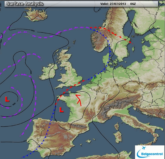
Surface analysis of July 27 2013 at 0800 CET. Steering feature is a
depression centered over west France. Overhead warm sector conditions
with some convergence lines passing by. (Source chart: Belgocontrol)
|
 |
|
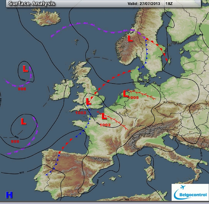
Surface analysis of July 27 2013 at 2000 CET. A new convergence line was
approaching Belgium from the southwest 12 hours later. (Source chart:
Belgocontrol)
|
 |
|
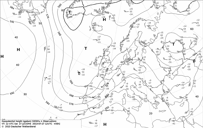
Upper air analysis 500 hPa of July 27 2013 at 1400 CET. Sharpening
trough west of the British Isles. Overhead a rather strong SSW flow of
warm and potentially unstable air. (Source chart: DWD via wetter3)
|
 |
|
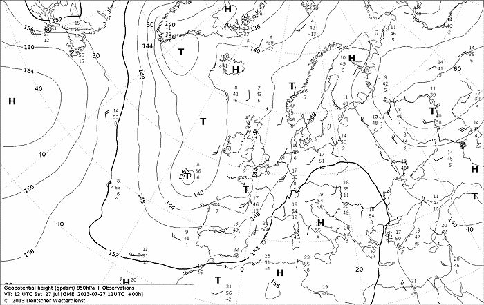
Upper air analysis 850 hPa of July 27 2013 at 1400 CET. Recognizable a
minor trough over west France, Belgium in a moderate (diffluent) SW flow, advecting warm air
(16°C). (Source chart: DWD via wetter3)
|
 |
|
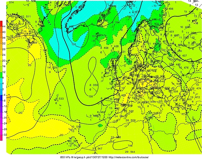
Upper air analysis 850 hPa of July 27 2013 at 1400 CET. Here we take a
look at Tw at 850 hPa, with a tongue of warm moist air covering west and
mid Europe with Tw exceeding 16°C. (Source chart: Meteocentre.com)
|
|
Loop of forecasted soundings for a 21 hours period (in steps of three
hours) of Brussels from July 27 2013, 0500 CET onwards. Included are
some thunderstorms indices: surface based CAPE went up to over 2400 J/kg, KI
37, TT
54, LI -10 = strong convective potential which may lead to scattered
to frequent thunderstorms. The SREH of 150 m²/s², in combi with the
moderate to strong CAPE, the environment would be favorable for multicell
thunderstorms (MCS) with a risk for a supercell. (Source: weatheronline.co.uk)
|
|
Loop of forecasted soundings for a 21 hours period (in steps of three
hours) of Ostend from July 27 2013, 0500 CET onwards. Included are some
thunderstorms indices: surface based CAPE went up to 1200 J/kg, KI
36, TT
53, LI -6 = moderate to strong convective potential which may lead to scattered
to frequent thunderstorms. The SREH of 150 m²/s², in combi with the
moderate to strong CAPE, the environment would be favorable for multicell
thunderstorms (MCS) with a risk for a supercell. (Source: weatheronline.co.uk)
|
 |
|
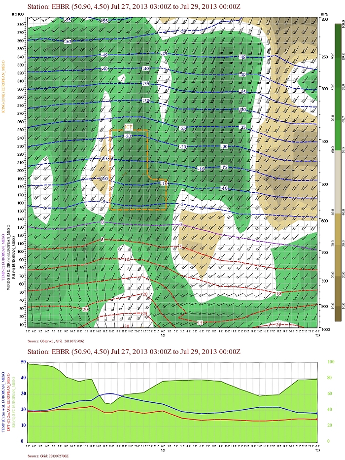
Forecasted vertical profile and surface temperature for Brussels Airport
of July 27 from 0500 CET and the following 48 hours. Legend of upper map: green-brown-white
is humidity in steps of 10% with darkest green being 90% or more, wind
in kt, temperatures each 5°C. In the morning hours and late evening of
July 27 two zones with humidity up to 225 hPa were crossing, both in
environments with rather significant shear in direction (and speed). (Source: Belgocontrol)
|
 |
|
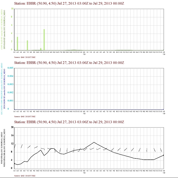
Forecasted precipitation, 2 meter temperature for Brussels Airport of
July 27 from 0500 CET and the following 48 hours. Legend: precipitation
darkest green = dynamical rain, light green is convective rain. Wind in
kt. In the morning a convective signal is forecasted, the zone of late
late evening did forecast only a weak dynamical signal which was
corrected to convective in the next run of this model (see below). (Source: Belgocontrol)
|
 |
|
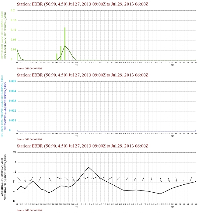
Forecasted precipitation, 2 meter temperature for Brussels Airport of
July 27 from 1100 CET and the following 48 hours. Legend: precipitation
darkest green = dynamical rain, light green is convective rain. Wind in
kt. (Source: Belgocontrol)
|
 |
|
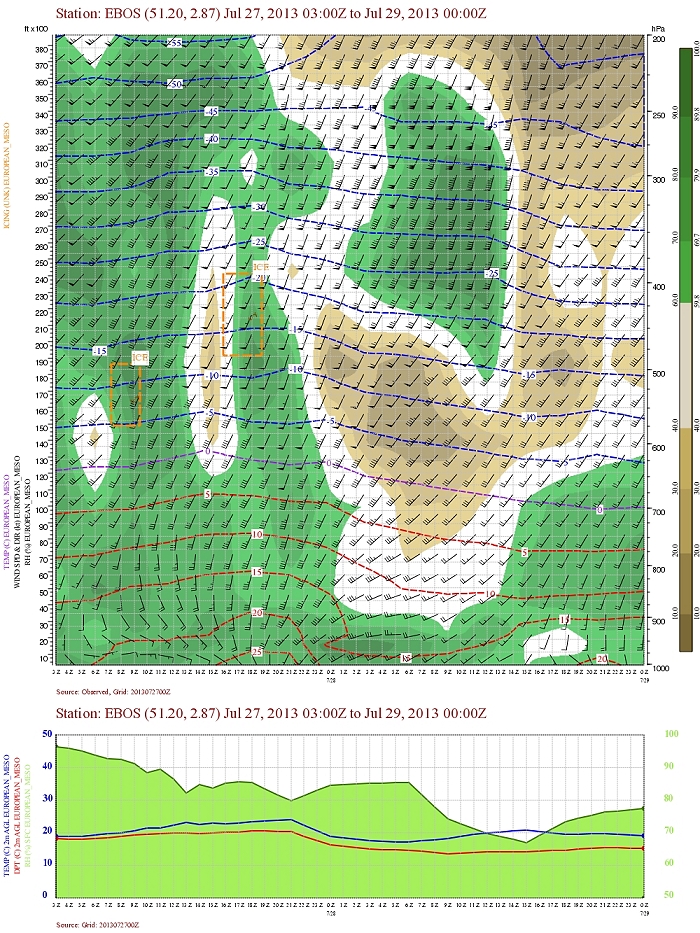
Forecasted vertical profile and surface temperature for Ostend Airport
of July 27 from 0500 CET and the following 48 hours. Legend of upper map: green-brown-white
is humidity in steps of 10% with darkest green being 90% or more, wind
in kt, temperatures each 5°C. Same pattern as Brussels can be detected. (Source: Belgocontrol)
|
 |
|
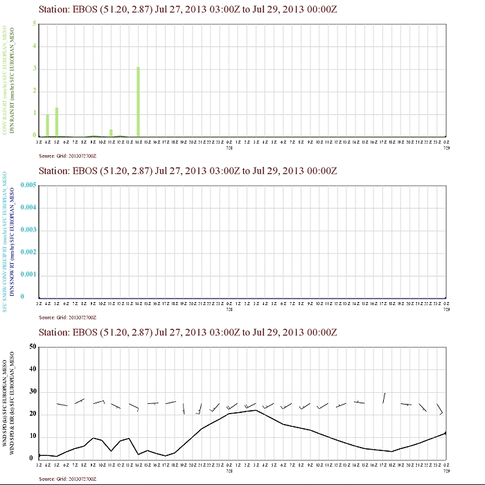
Forecasted precipitation, 2 meter temperature for Ostend Airport of July 27 from
0500 CET and the following 48 hours. Legend: precipitation
darkest green = dynamical rain, light green is convective rain. Wind in
kt. Two peaks in convective rain in morning and evening. After the last
precipitation zone also a clear wind shift with increasing speeds. (Source: Belgocontrol)
|
 |
|
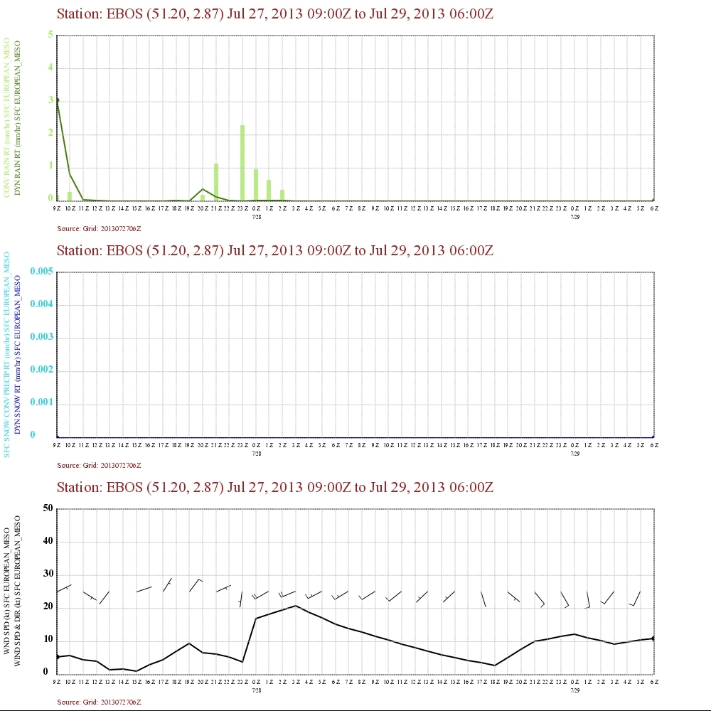
Forecasted precipitation, 2 meter temperature for Ostend Airport of July 27 from 1100 CET and the following 48 hours. Legend: precipitation
darkest green = dynamical rain, light green is convective rain. Wind in
kt. Next run of this model with even a more intense wind shift. (Source: Belgocontrol)
|
 |
|
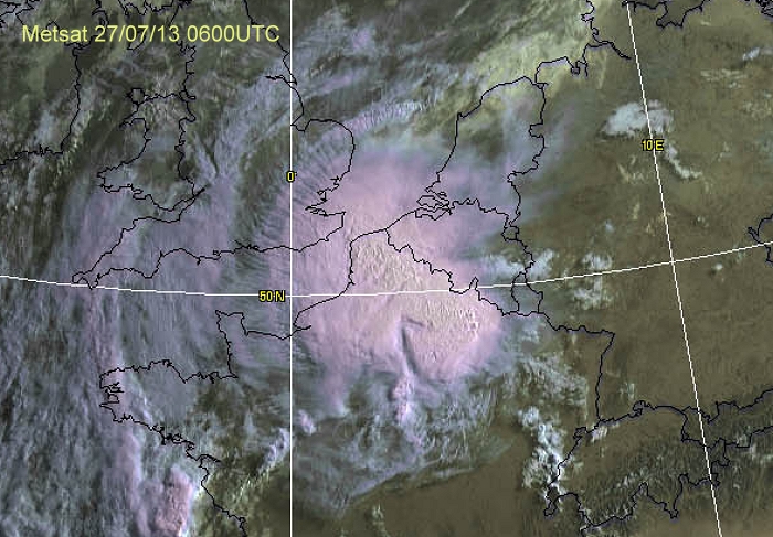
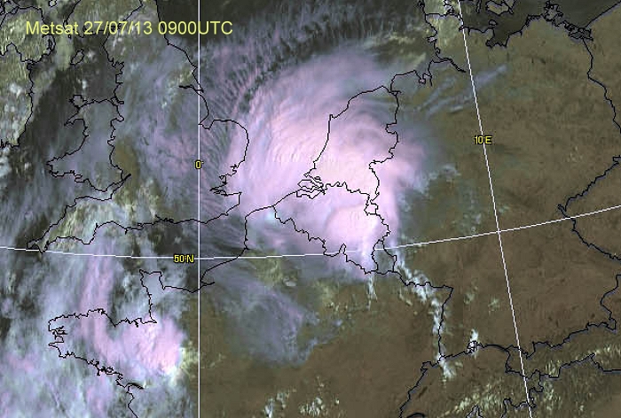
Satellite picture of July 27 at 0800 CET in the visible channel. An MCS
thunderstorm over north France is approaching the Belgian border. (Source:
Metsat via Wokingham weather)
|
 |
|
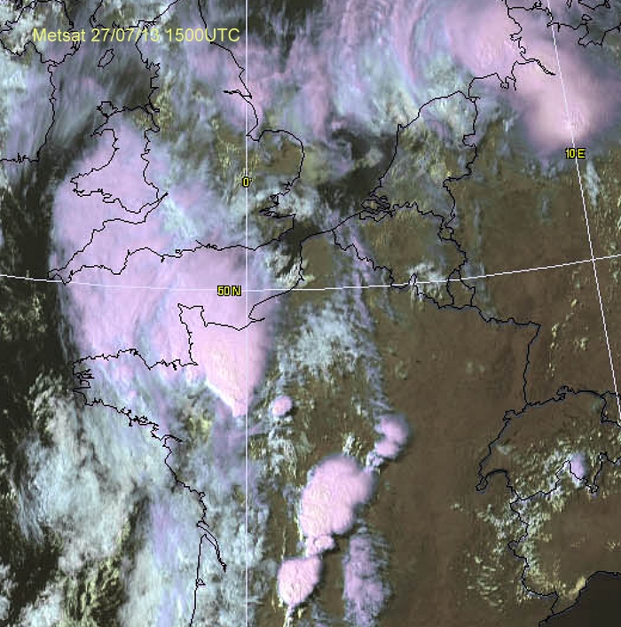
Satellite picture of July 27 at 1100 CET in the visible channel. The MCS
thunderstorm has arrived over southern Netherlands, but also still
affecting eastern parts of Belgium. (Source: Metsat via Wokingham
weather)
|
 |
|
Satellite picture of July 27 at 1700 CET in the visible channel. An new
developing MCS thunderstorm over northwest France. (Source: Metsat via
Wokingham weather)
|
 |
|
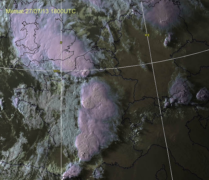
Satellite picture of July 27 at 2000 CET in the visible channel. The MCS
thunderstorm approaches western parts of Belgium, but would also further
grow on its eastern side so that entire Belgium would be affected during
the evening and night. (Source: Metsat via Wokingham weather)
|
Radar loop (rainfall rate in mm/hr) of July 27-28 2013 between 0800-0200 CET. Two squall-lines in a time window of 12 hours crossing Belgium. (Source radar picture: Belgocontrol)
|
 |
|
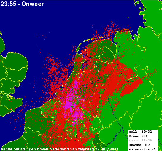
27/07/2013. Amount of discharges (of two thunderstorms in different
colors) over the Benelux with weakest activity over the western and
eastern parts of Belgium. It would turn out the day with the highest
amount of discharges of the entire summer. (Source picture: Buienradar)
|
Metars (hours in UTC) of some airports. Translation: copy paste each obs via
metar-decoder
EBBR 270520Z VRB01KT 0200 R25L/0325V1900U R25R/0300V0550N
R02/0400V1200U FG SCT001 SCT002 19/18 Q1009 BECMG 1500 BR=
EBOS = Middelkerke - Ostend
EBOS 270520Z 02004KT 2200 BR FEW020 19/17 Q1009 BECMG 3000
BR=
EBFN = Koksijde
EBFN 271825Z VRB03KT 9999 FEW023 SCT090 BKN140 22/20 Q1004
BLU=
EBFS = Florennes
EBFS 270655Z AUTO VRB02KT 9999 FEW110/// BKN130/// 21/19
Q1009 BLU=
|
 |
|
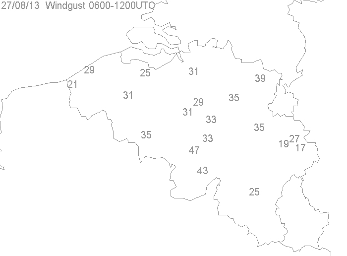
27/07/2013. Wind gusts (in knots) taken from the synops of 1200 UTC. Winner was
Charleroi with 47 kt, followed by Florennes with 43kt.
|
 |
|
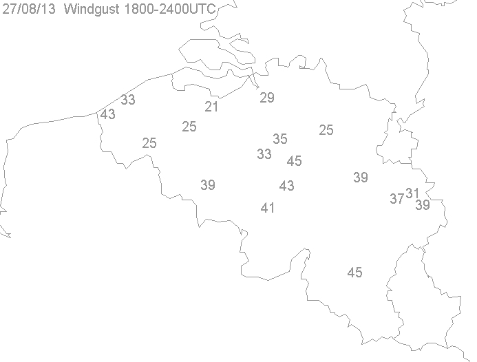
27/07/2013. Wind gusts (in knots) taken from the synops of 0000 UTC. Winner was
Beauvechain & St-Hubert with 45 kt, followed by Koksijde & Ernage with
43 kt.
|
 |
|
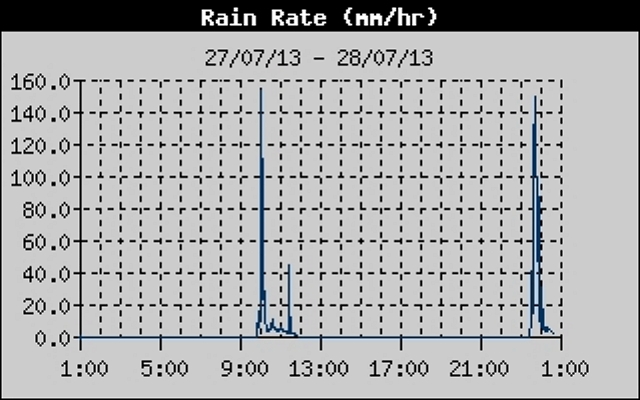
27/07/2013. Taken from an automatic weather station at Kampenhout in
local time: rain
rate with the two thunderstorms passing by within a 14 hour hour period with
an almost identical rain rate of almost 160 mm/h.
|
 |
|
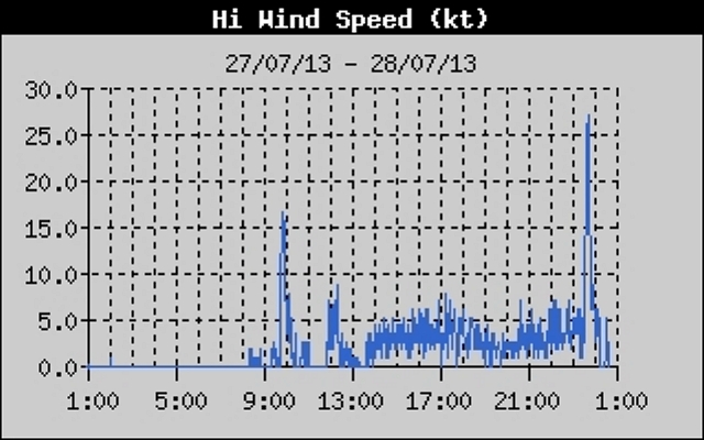
27/07/2013. Taken from an automatic weather station at Kampenhout in
local time: gusts
in kt indicating two thunderstorms passing by within a 14 hour period, with the
strongest gust in the second storm.
|
 |
|
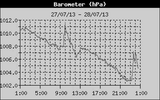
27/07/2013. Taken from an automatic weather station at Kampenhout in
local time: pressure
in hPa indicating two thunderstorms (sudden higher pressure) passing by within a 14 hour
period. It reveals that the evening storm had two pulses of strong rain
& wind.
|
 |
|
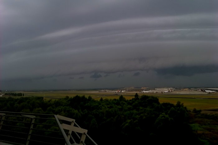
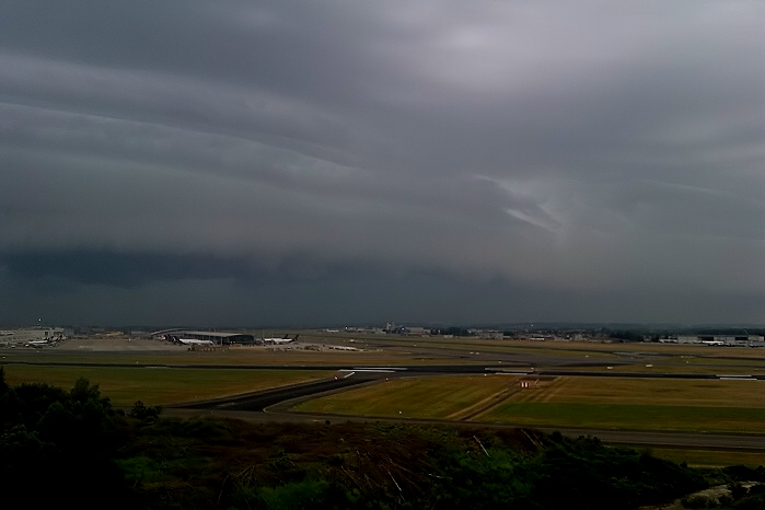
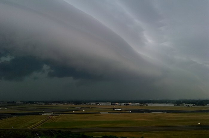
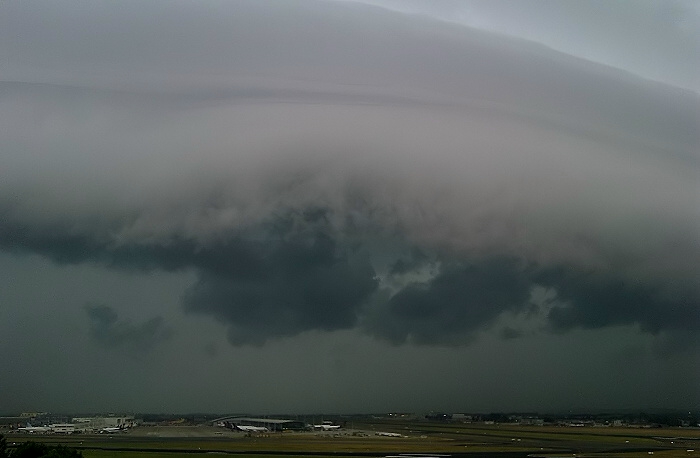
27/07/2013 0935 SSW. The morning MCS with nice shelf cloud was covered at Brussels Airport by
colleague meteorologist Sebastian Verachtert in the following 6 photos.
|
 |
|
27/07/2013 0935 W.
|
 |
|
27/07/2013 0939 WNW.
|
 |
|
27/07/2013 0940 W.
|
 |
|
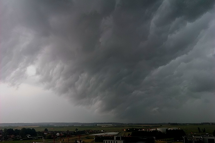
27/07/2013 0942 SSE. Whales mouth beneath the shelf passing over.
|
 |
|
27/07/2013 0945 NNW. Opposite side.
|
 |
|
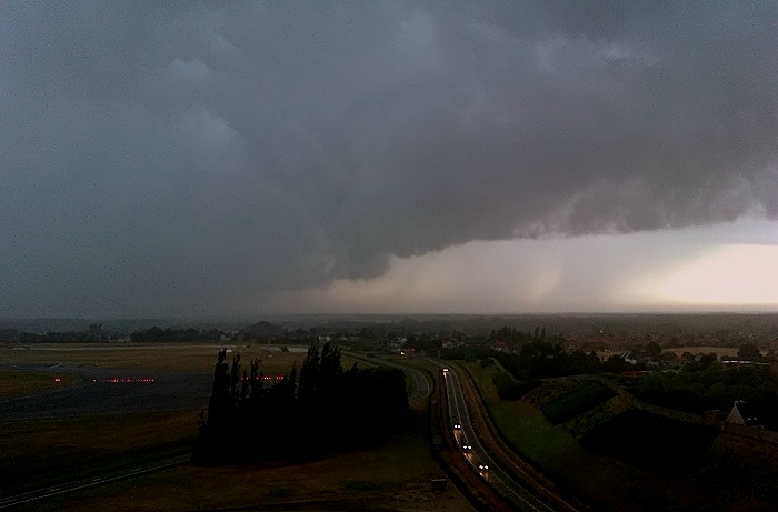
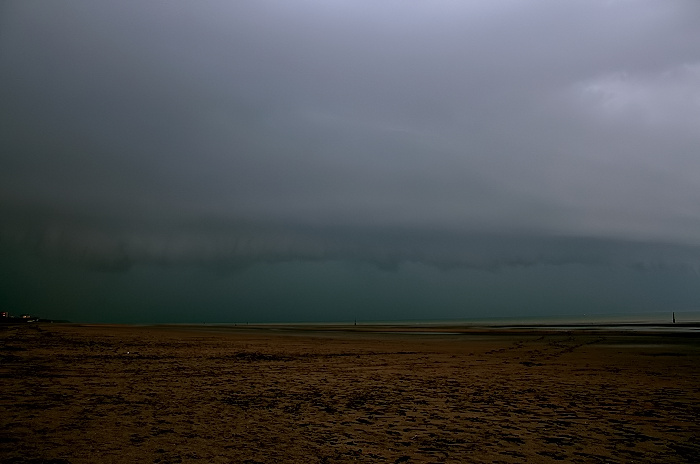
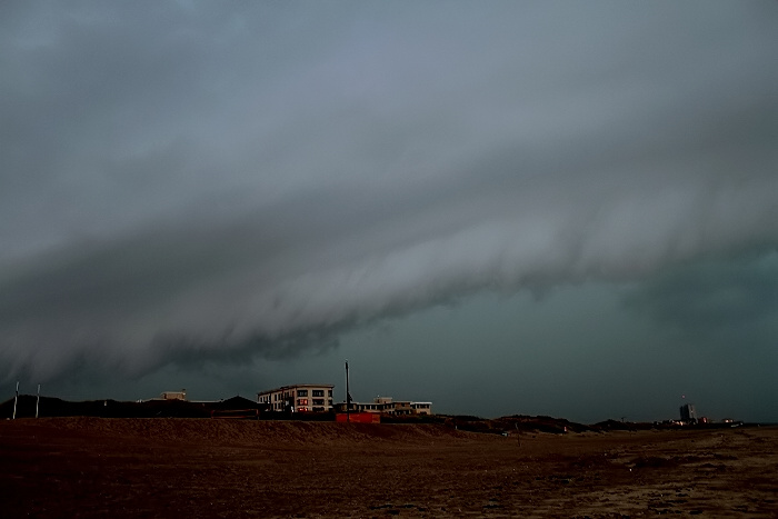
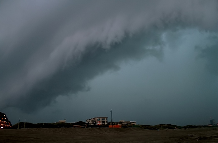
27/07/2013 2119 SW. The evening MCS was covered by myself at the Belgian coast. In the far distance a weak arcus / shelf cloud could
be detected. Buildings left side are located in Oostduinkerke.
|
 |
|
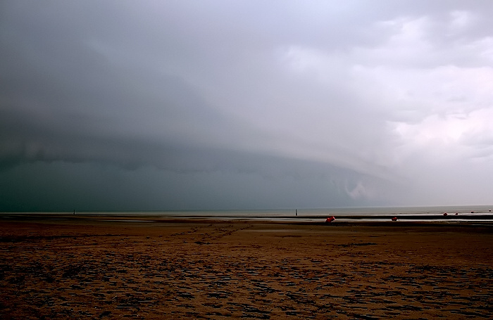
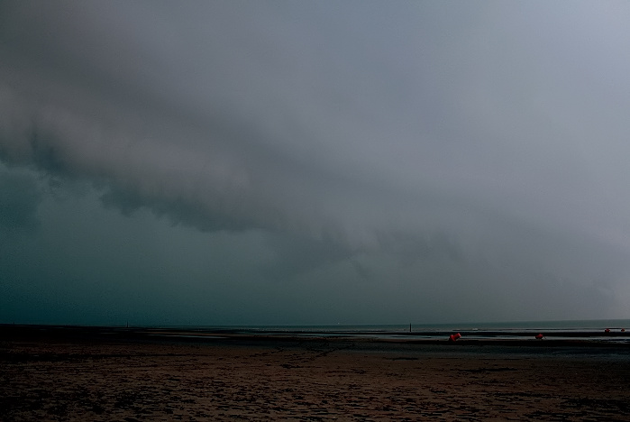
27/07/2013 2125 W. Approaching.
|
 |
|
27/07/2013 2126 W. Approaching.
|
 |
|
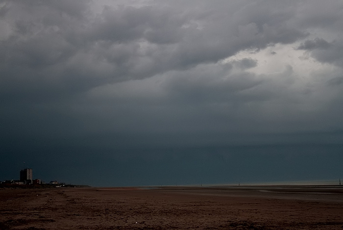
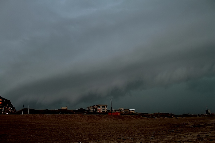
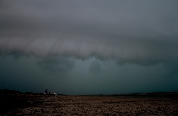
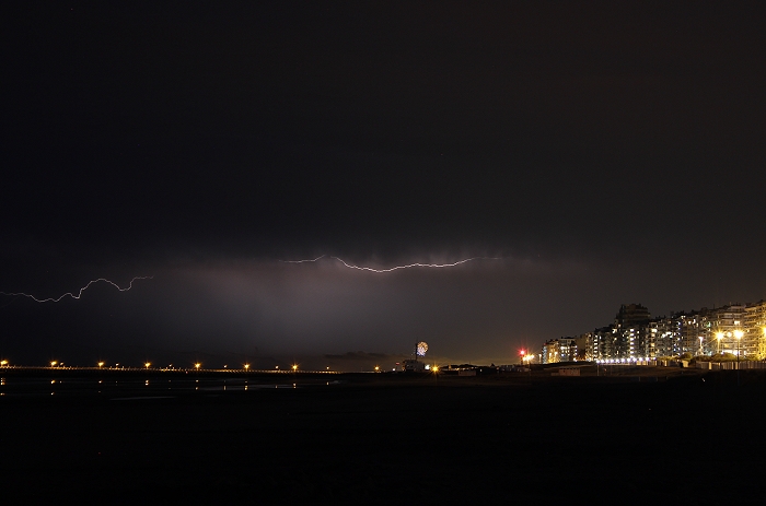
27/07/2013 2126 W. Over the North Sea a more pronounced shelf began to
appear ahead the
developing MCS thunderstorm.
|
 |
|
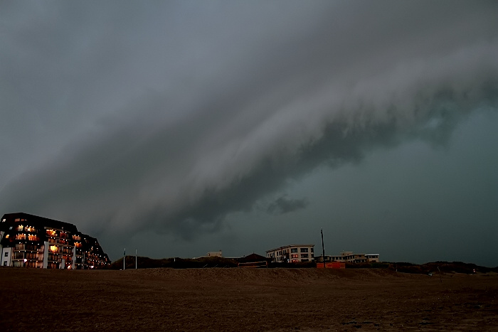
27/07/2013 2127 SSW. Other side inland with approaching arcus & shelf.
|
 |
|
27/07/2013 2127 SSW. 24 seconds later.
|
 |
|
27/07/2013 2127 SW.
|
 |
|
27/07/2013 2128 W..
|
 |
|
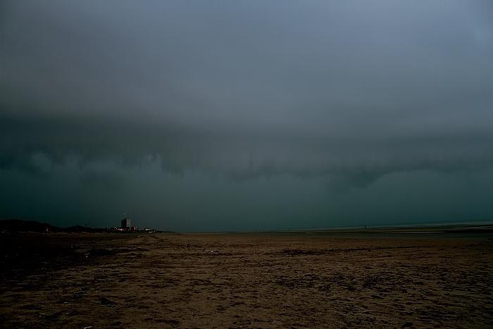
27/07/2013 1928 SSW. 20 seconds later.
|
 |
|
27/07/2013 1928 SSW. 15 seconds later, arcus almost overhead. A couple
dozen seconds later it passed over with gusts of around 40 kt, blustery
rain with some small hail stones as well.
|
 |
|
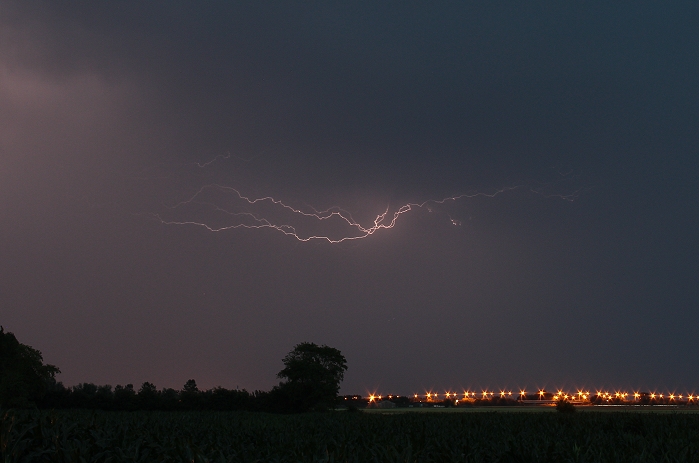
27/07/2013 2227 SE. A couple of hours later, on the backside of the
storm, a few discharges could be captured.
|
 |
|
27/07/2013 2235 SE.
|
 |
|
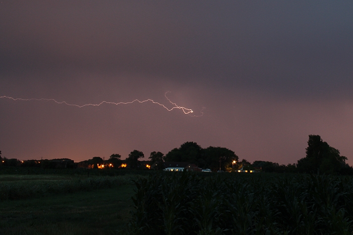
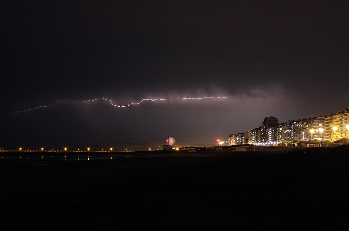
27/07/2013 2305 NE. Nieuwpoort bad on right side. Also with some
artificial firework in the far back.
|
 |
|
27/07/2013 2306 NE.
|