SkyStef's weather page
|
|
SkyStef's weather page |
Weather picture of the month May 2005
|
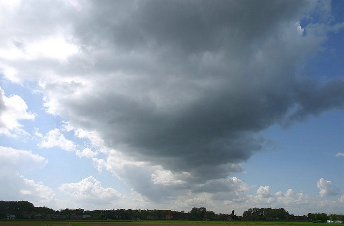
| Picture taken towards WSW at Kampenhout on April 27 2005. |
| A cloud
street is a type of organized convection. It
has the form of an extended line of cumulus cloud almost parallel to the
wind direction, often in an otherwise lightly cloudy sky. Various sources
of thermals spaced across the wind may give rise to parallel cloud streets.
It appears that such streets may also be produced in an air mass in which
the convection layer has a well-marked top and in which the wind direction
is almost constant. Cloud streets occur when: - Surface winds are between 10-15kt. - Wind direction is nearly constant with height in the convective layer. - An inversion or stable layer limits the vertical development of convective currents, usually at a height of 1.5 to 2 km. - The wind speed should increase with height to a maximum of at least 20 kt in the middle or upper part of the convection layer. Above these levels the wind may decrease or increase again.
The picture shows a cumuliform cloud street in a stabilizing WSW'ly flow with surface winds of 12kt. |