SkyStef's weather page
|
|
SkyStef's weather page |
Weather picture of the month July 2008
|
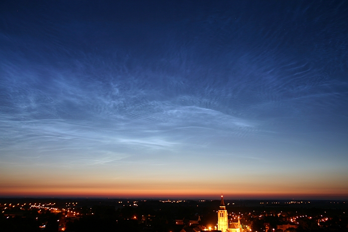
| Picture taken at Steenokkerzeel on July 2 2008 at 0416 hours CET. |
| Belonging to the group of special
clouds, noctilucent
clouds are one of the most beautiful
phenomena on the nightly sky. On the northern hemisphere they do occur in
the period mid May - mid August with a maximum of appearances around the
weeks of solstice. In the past these clouds were seen rather seldom, but in
the last couple of years they seem to show up on a more frequent base. Also
at lower latitudes (like over Belgium) the entire sky can sometimes be
overwhelmed with a layer of these clouds.
During 2007 a satellite was launched to gain more info about these clouds. At an altitude of around 80 km, there exists a layer of a few km thick which consists small particles (like cosmic dust) with ice crystals sublimated on them. Temperature ranges between -90 and -145°C, mean speed of the wind is around 150 km/h, but sometimes up to 700 km/h. Upward and downward motions are often present giving these clouds a rather turbulent appearance. In fact, the structure resembles a lot to the "normal clouds" to be found in the troposphere. From the earth's point of view, these clouds become visible
in a time window well before sunrise and/or well after sunset, namely when the sun stands between 5 and 13 degrees
below the horizon. The picture shows bright noctilucent clouds which were visible during the early morning of July 2 2008. Events of one hour, shortened in a time-lapse of 30 seconds, can be found via this link |