|
| High clouds, CH
base usually 20,000 ft (6km) or above |
| Type |
Precipitation (ppn) etc.
|
Range of cloud base |
C code |
| Cirrus (Ci) |
No ppn. Halo may occur. Dense
patches may veil or hide the sun |
Usually 20,000-40,000 ft (6-12km)
|
0 |
| Cirrocumulus (Cc) |
No ppn. Position of sun/moon can usually be seen
|
Similar |
1 |
| Cirrostratus (Cs) |
No ppn. Halo often occurs. Outline of sun normally visible
|
Cs can progressive lower of
base and become As |
2 |
| Medium clouds, CM base usually between
6,500 ft (2km)000 ft (6km) |
| Type |
Precipitation (ppn) etc. |
Range of cloud base |
C code |
| Altocumulus (Ac) |
Ac Castellanus occasionally produces ppn.
Can be thick enough to hide sun/moon |
Usually 6,500-20,000 ft (2-6km). |
3 |
| Altostratus (As) |
Often continuous ppn reaching the ground
with sun/moon hidden. Thinner As shows sun/moon as ground glass appearance |
Altostratus may thicken with progressive
lowering of the base to become Ns |
4 |
| Nimbostratus (Ns) |
Normally continuous ppn (sometimes
moderate/heavy) with sun/moon hidden |
Usually between the surface and 10,000 ft
(3km) |
5 |
| Low clouds, CL base usually below 6,500 ft
(2km) |
| Type |
Precipitation (ppn)
etc. |
Range of cloud
base |
C code |
| Stratocumulus (Sc) |
Normally no ppn, but slight ppn possible
over coasts/hills. Can be thick enough to hide sun/moon |
Usually between 1,000 ft* (300m) and
4,500 ft (1,350m) but may often be observed to 6,500 ft (2km) |
6 |
| Stratus (St) |
Near coasts/hills, ppn can be
considerable, but it may be falling from higher cloud such as Ns. Can be
thick enough to hide sun/moon. However when thin, sun/moon can be clearly
visible |
Usually between the surface and 2,000 ft
(600m) but may sometimes be observed to 4,000 ft (1,200m) |
7 |
| Cumulus (Cu) |
Light showers are possible |
Usually between 1,000 ft* (300m) and
5,000 ft (1,500m), but may sometimes be observed to 6,500 ft
(2km). After initial formation, a rise in temperature often leads to a
rise in cloud base |
8 |
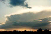
| Cumulonimbus (Cb) |
Always reported when
showers/thunderstorms/hail occurs. Squally winds are also common |
Usually between 2,000 ft* (600m) and
5,000 ft (1,500m), but may sometimes lower to near surface, or be as
high as 6,500 ft (2km) |
9 |
|