SkyStef's weather page


home  |  e-mail    


1-7 day forecast for thunderstorms via KO Index

animation

00 UTC

animation

06 UTC

animation

12 UTC

animation

18 UTC


Run of 06 UTC


Source: Wetter3

 
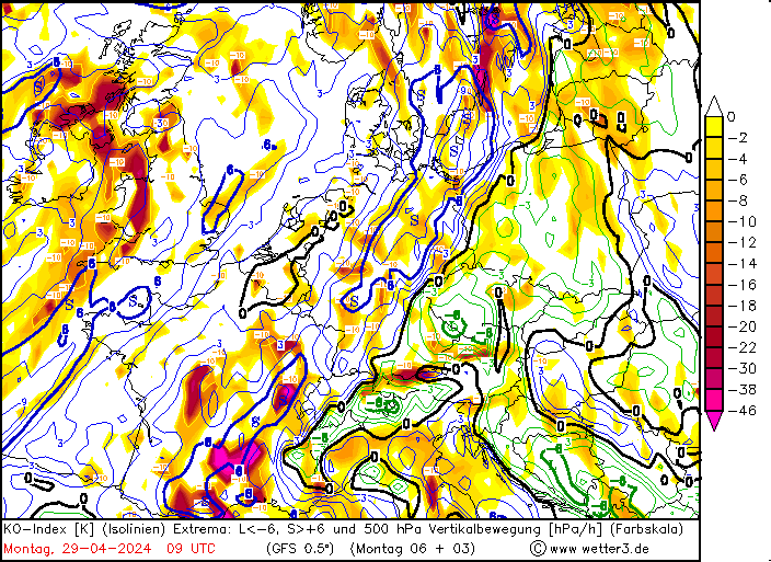
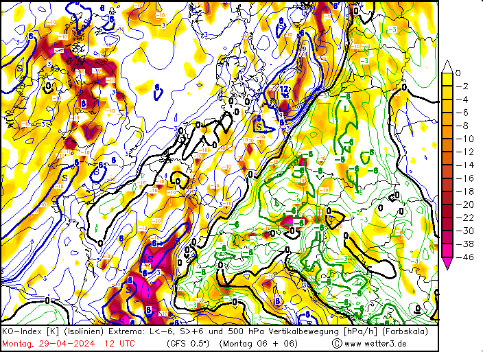
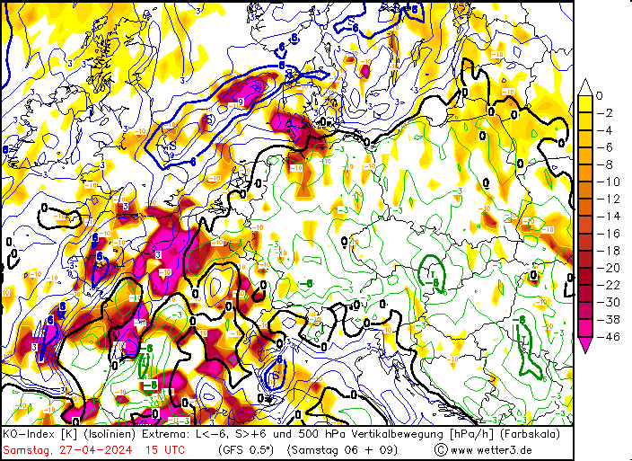
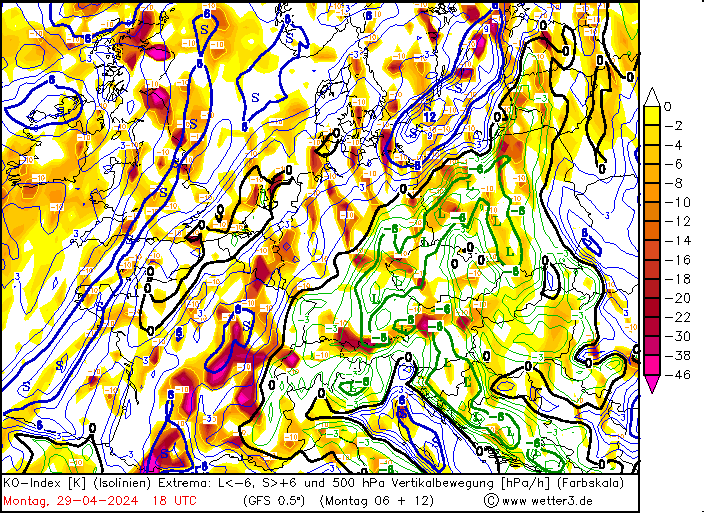
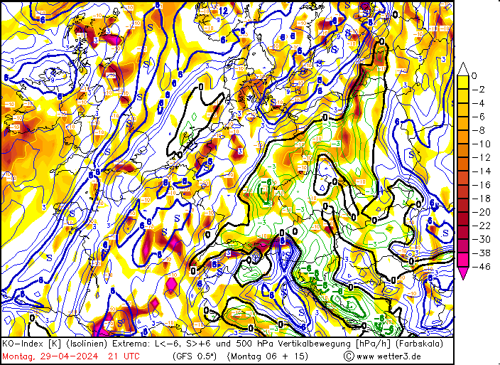
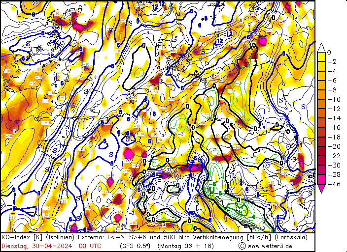
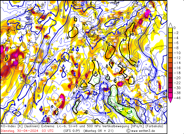
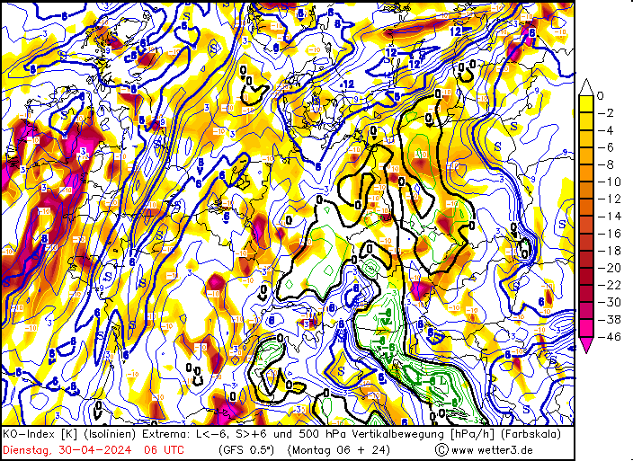
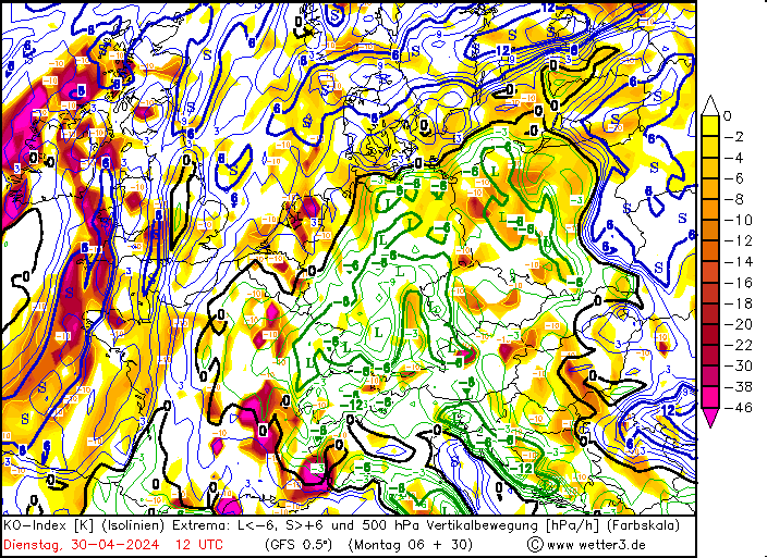
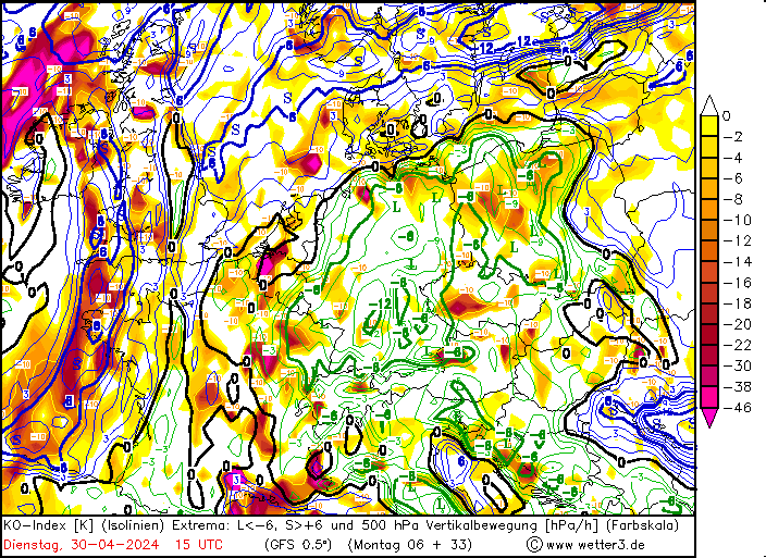
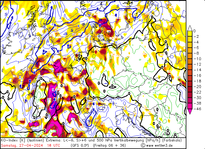
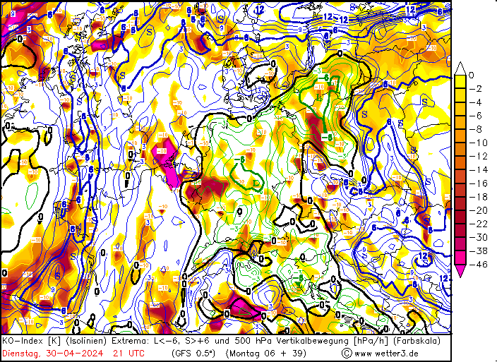
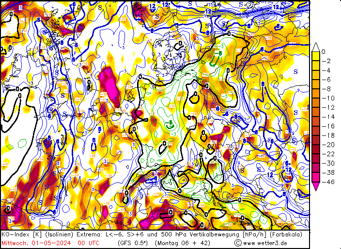
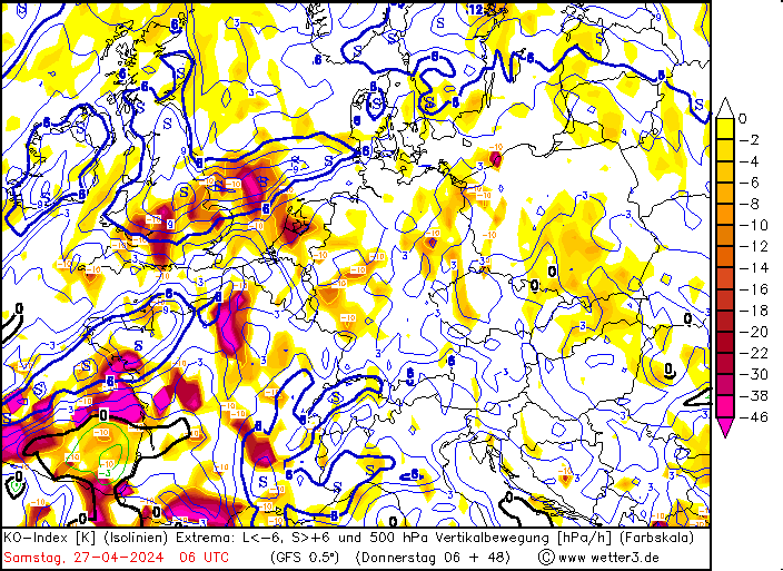
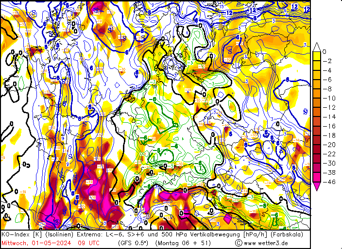
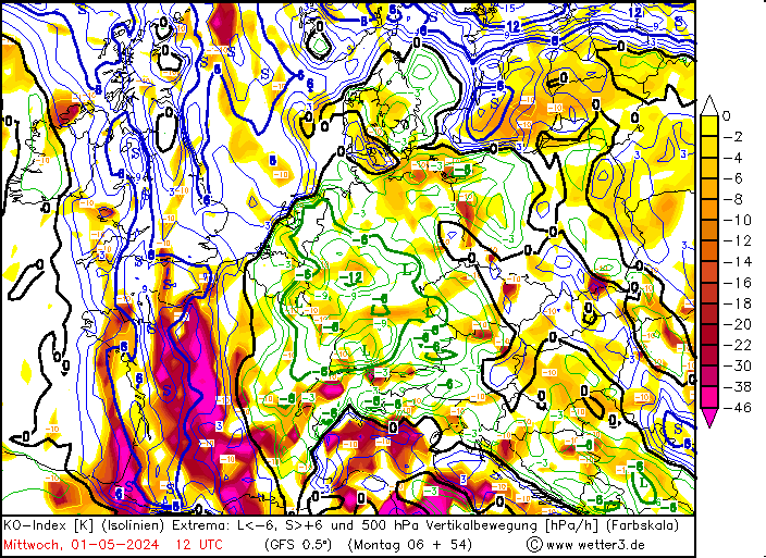
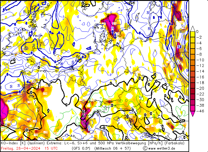
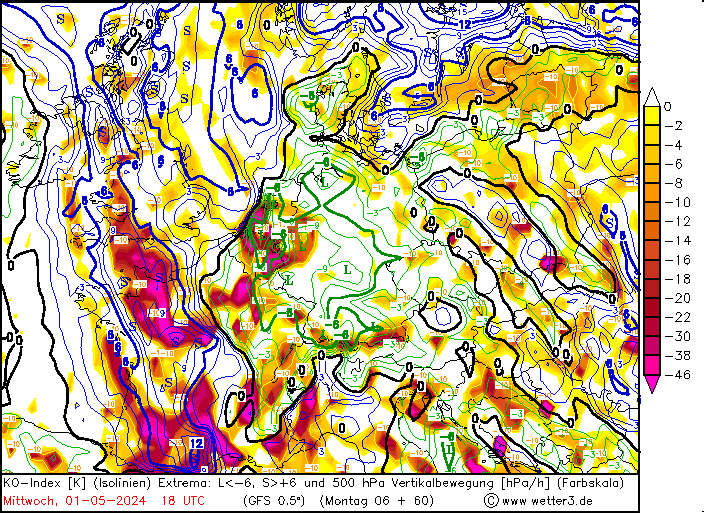
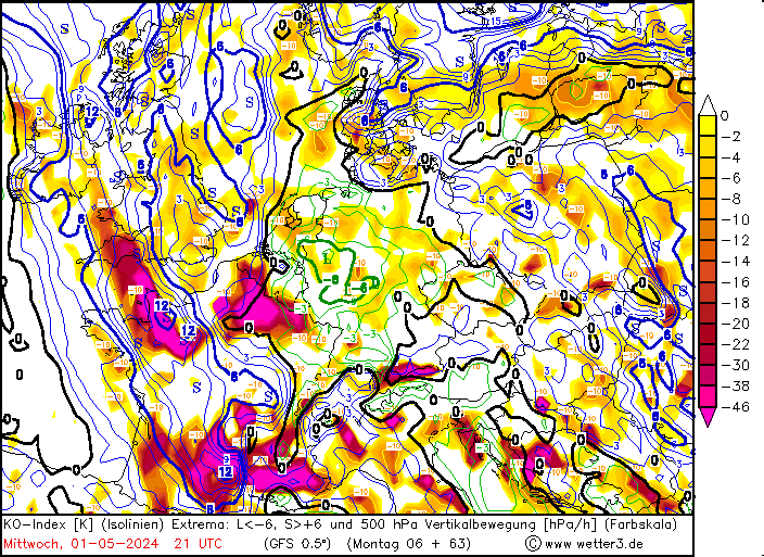
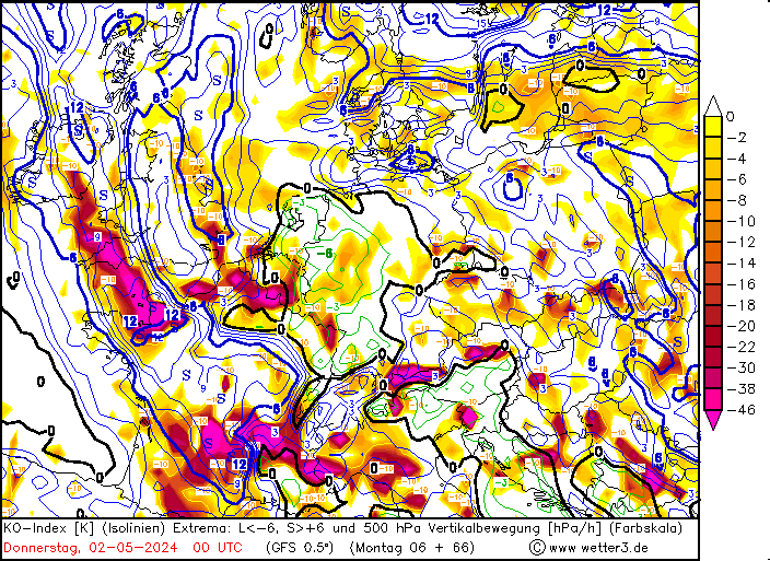
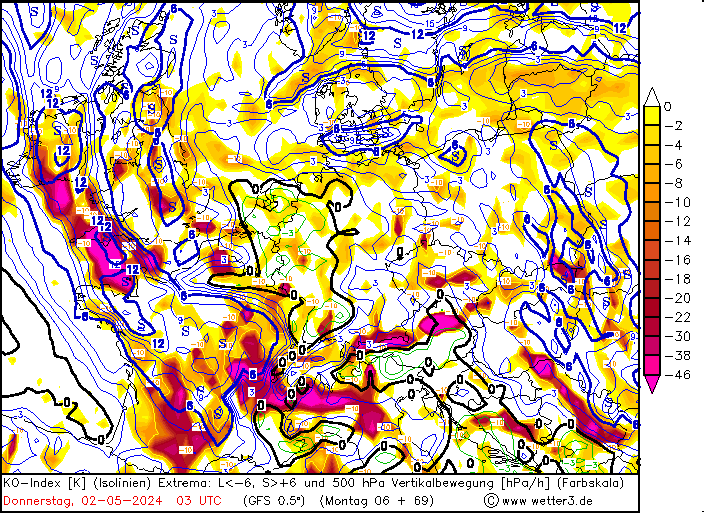
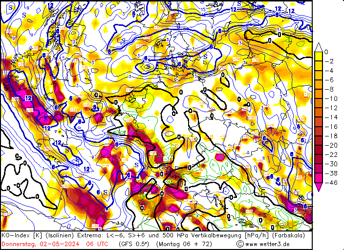
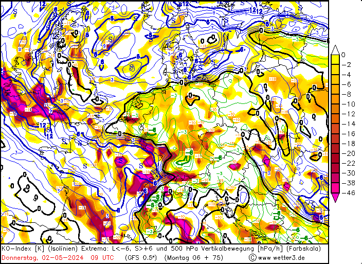
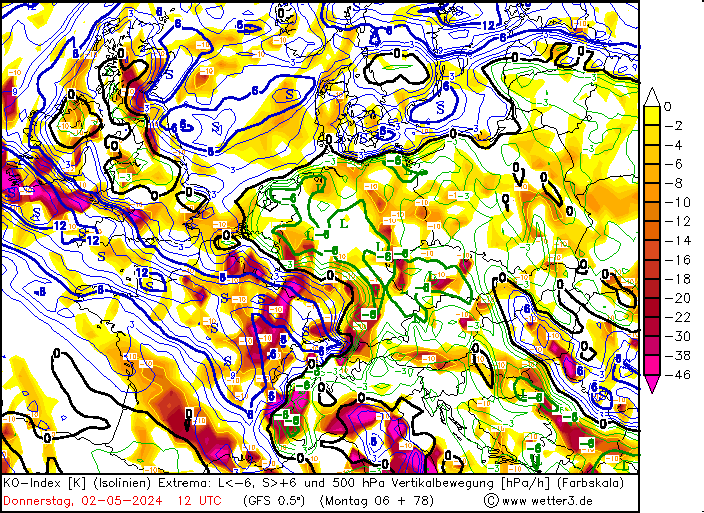
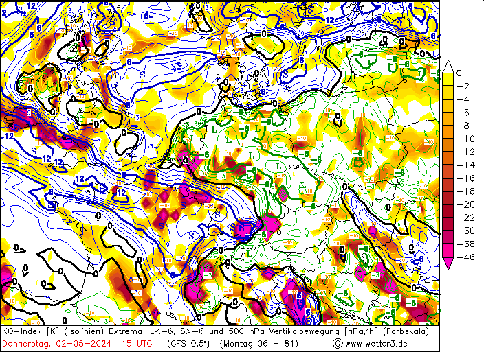
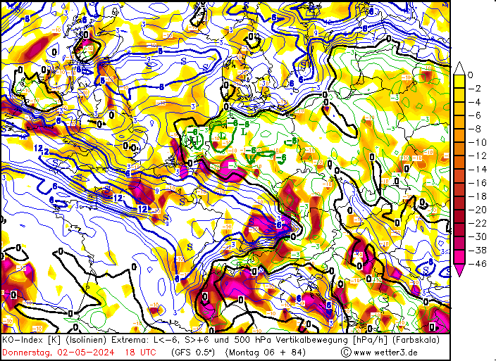
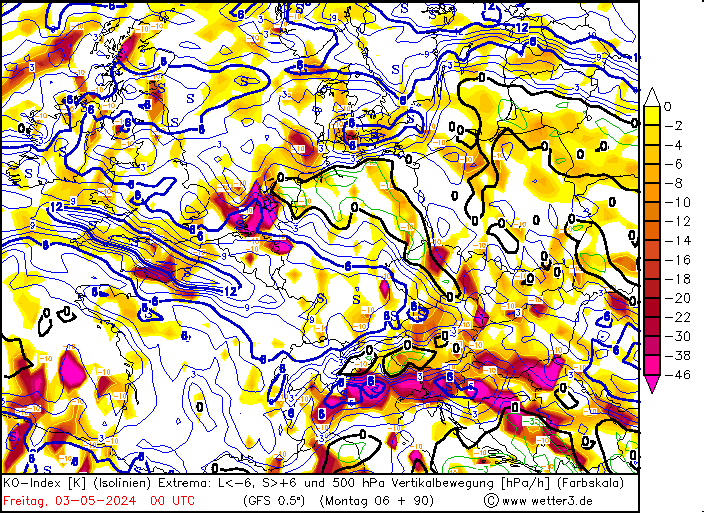
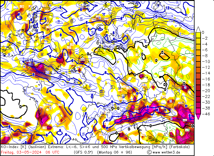
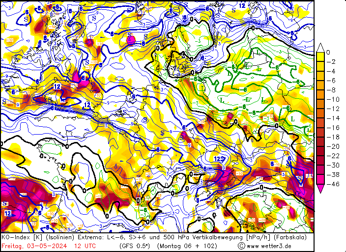
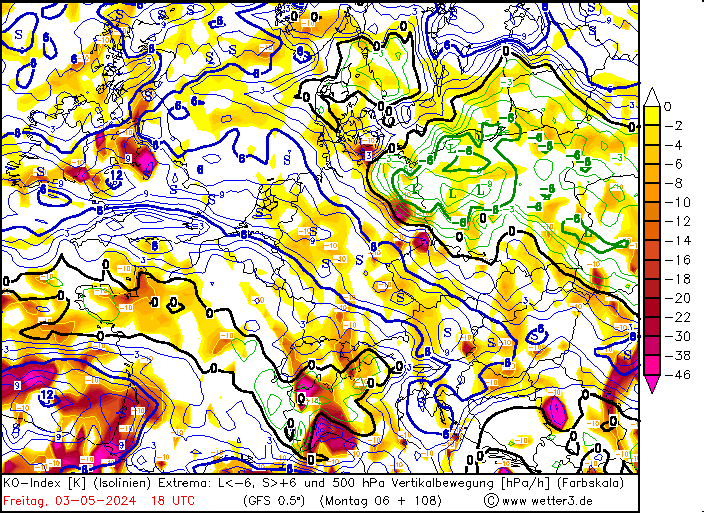
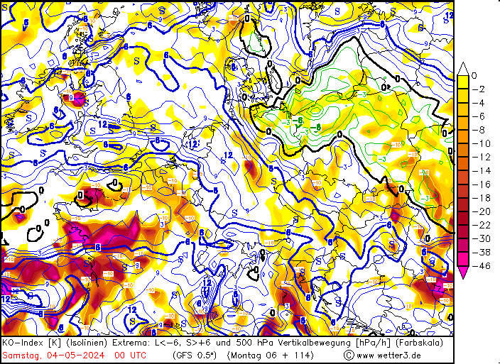
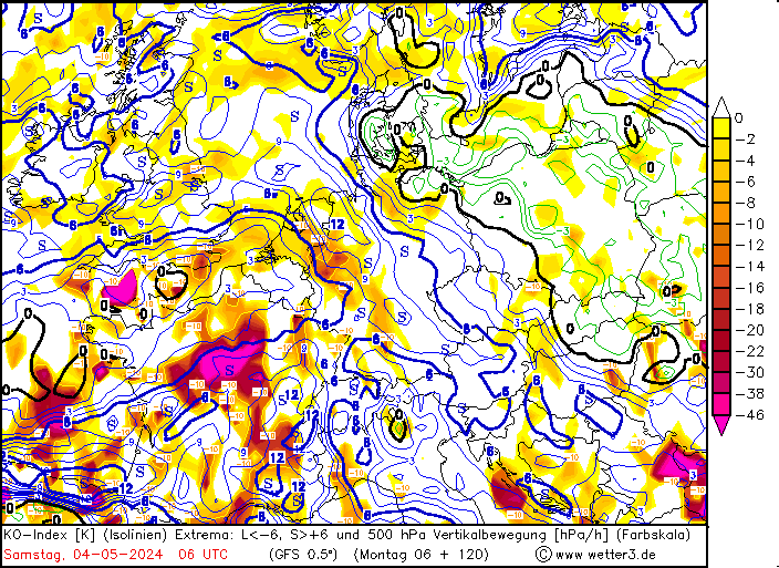
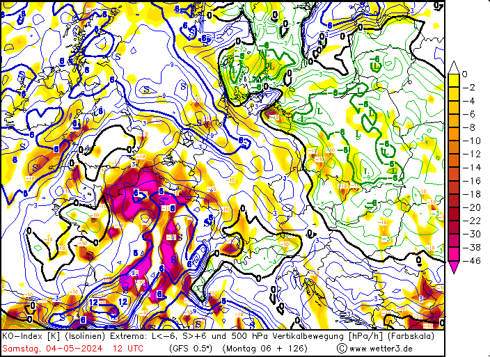
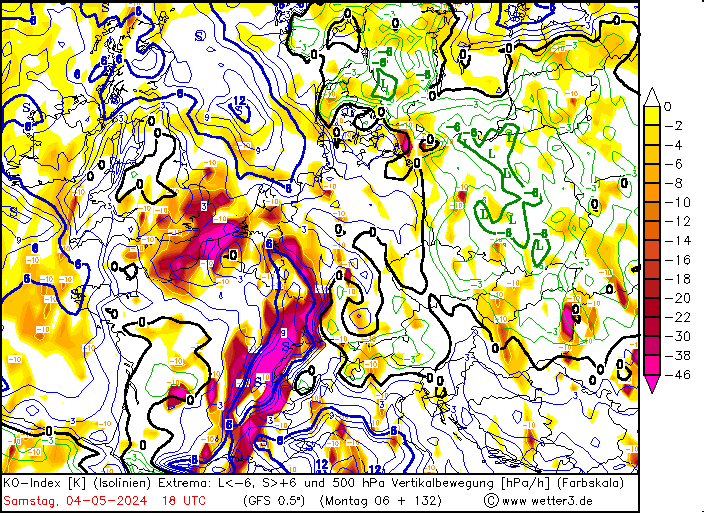
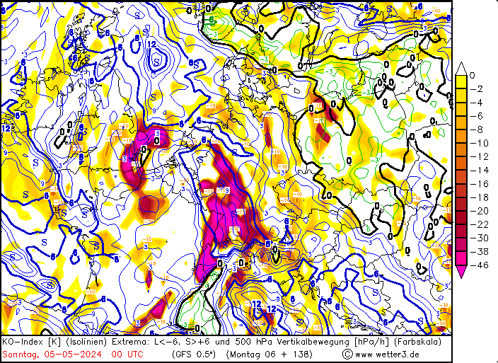
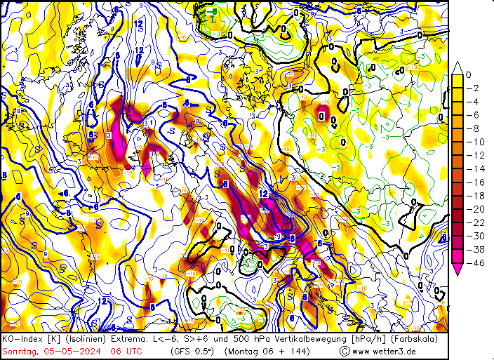
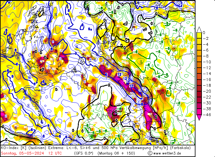
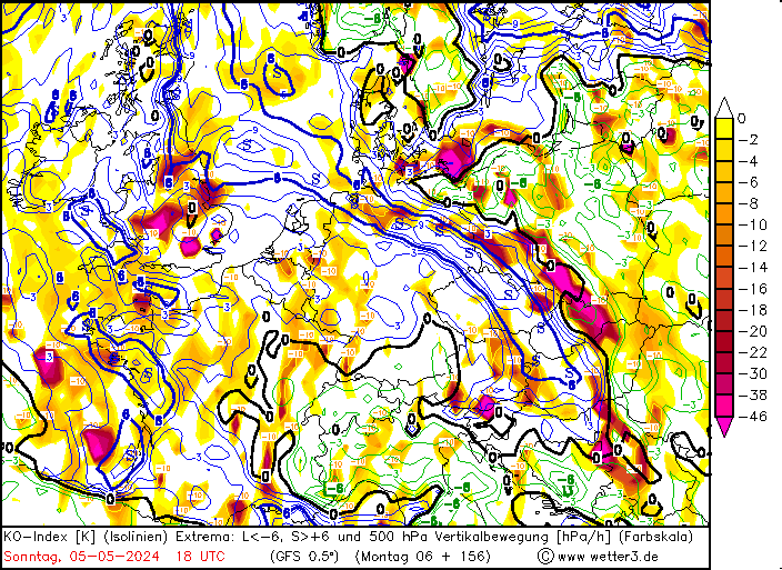
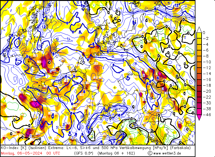
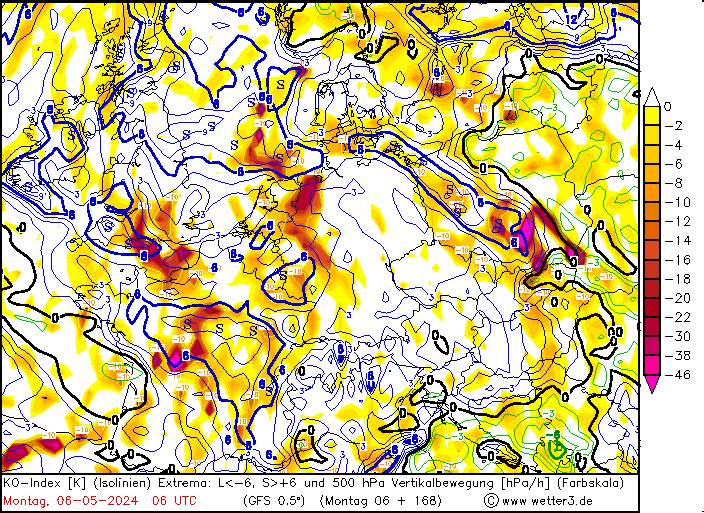
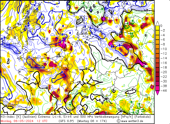
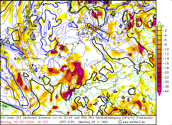
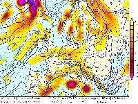
Legend.

KO Index = blue lines with values. (S = >+6 = stable, L = < -6 = unstable).
Vertical motion forced by dynamical forcing at 500 hPa = zones in color (hPa/hour).


Critical values KO.

> 6: no potential risk thunderstorms.
2-6: small potential risk for thunderstorms.
< 2: potential risk for thunderstorms.

Vertical motion: large negative values = strong ascent


Combination of both:

Stable KO region + negative motion = frontal zone. If the negative motion is positioned on a strong gradient in the KO indices between a stable and unstable zone: front is potentially unstable with risk for severe embedded thunderstorms
Unstable KO region + negative motion = active upper trough with risk severe thunderstorms
Unstable KO region without negative motion = air mass instability which may produce thunderstorms due to diurnal heating (mainly in the afternoon)


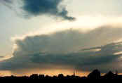
Back to weather forecasts for thunderstorms


Back to weather list